
Kanangra to Kowmung River
Blue Mountains National Park


Menu
GPS Tracks
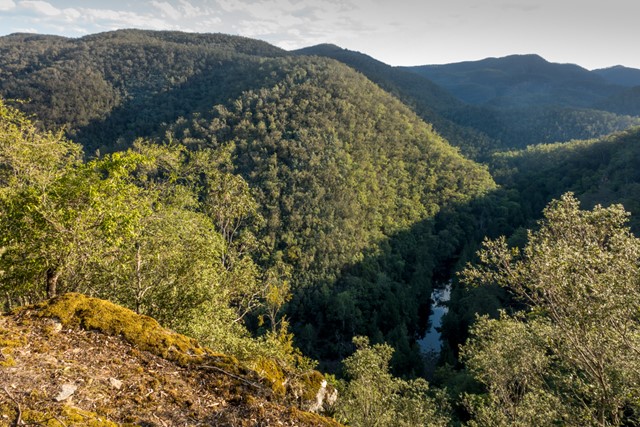
A tough overnight walk from Kanangra Walls in the Blue Mountains, down to the wild Kowmung River. This describes the shortest route from Kanangra Walls.

Getting there
Start at Kanangra Walls car park (end of Kanangra Walls Road).
Maps
Kanangra 8930-3S 1:25K
Yerranderie 8929-4N 1:25K
Route/Trail notes
The first part of the walk is along the well-marked Plateau Track, before veer right onto an unnamed track that heads towards Maxwell Top [Kanangra GR342358]. Follow this track for just over a kilometre before descending the cliffs near Murrarang Top, and then follow the Gingra Trail which follows the Gingra Range. Take the Roots Ridge Track off the Gingra Trail, which follows Roots Ridge steeply down to the Kowmung River.
Permits/Costs
National Park entry fee applies (or annual pass)
Other References
Track notes, photo and GPS route: https://hikingtheworld.blog/2018/01/07/kanangra-walls-to-kowmung-river/
For alternative overnight walks to the Kowmung River, see Guide to Overnight Sydney Walks: https://hikingtheworld.blog/index-of-hikes/overnight-walks-near-sydney/
 Kanangra to Dex Creek, 100 man cave (KML)
 26
26 2
2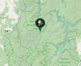
Comments
Nobody has commented on this walk yet. If you've done it then tick it off and add a comment.