


 3.2
3.2 1
1- Garraan-gurr Walking Track (Orara East State Forest) (New South Wales)
- Gumgali Walking Track (Orara East State Forest) (New South Wales)
- Rainforest Walking Track (Orara East State Forest) (New South Wales)
- Muttonbird Island Nature Reserve (New South Wales)
- Look at me now Headland walk (New South Wales)
End Peak Walking Track (Orara East State Forest)
New South Wales
Menu
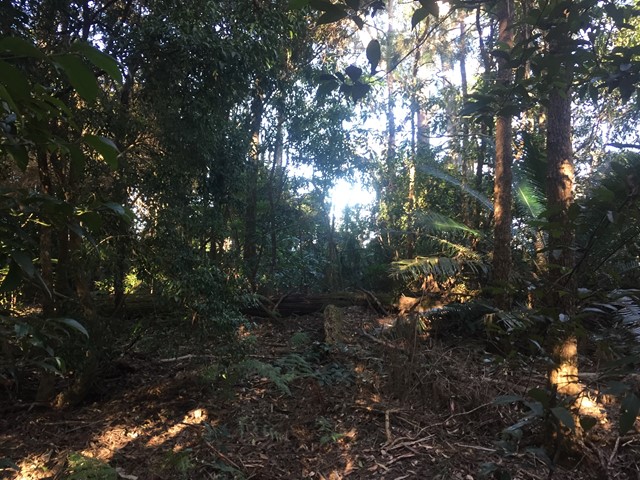
End Peak walking track is a challenging walk that offers rewarding panoramic views of Coffs Harbour from Ulidarra National Park’s highest point. It’s great for birdwatching and for a picnic with a view.
If you’re looking to experience nature and get away from it all for a few hours, End Peak walking track is for you. A short drive from Coffs Harbour, and within moments you’ll be surrounded by a rich tapestry of vibrant green colours.
This challenging escarpment walk traverses old-growth blackbutt forest, tall wet forests and rainforests. There are a few steep sections of track, but they just add to the adventure and the challenge. Bring a picnic lunch and enjoy picnicking from the highest point in Ulidarra National Park, with filtered glimpses of Coffs Harbour.
There’s plenty of native wildlife to admire along the way, including koalas and an abundance of birdlife, so if you enjoy birdwatching, keep your binoculars handy. Ulidarra National Park is home to 125 bird species, so you’re bound to see something colourful along the way, such as the beautiful satin bowerbird.
Lookouts
Picnic Facilities
Toilets
Rainforest
Eucalypt Forest
442m
Maximum Elevation
Getting there
How do you get to the start of the walk?
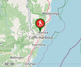
End Peak walking track starts at Sealy lookout in Bruxner Park Flora Reserve. To get there:
- From Coffs Harbour, travel north on the Pacific Highway for approximately 5km.
- Turn left onto Bruxner Park Road and wind your way up the escarpment past the banana farms
- Turn left at Scenic Road and continue to Sealy lookout
- The walk starts to the west of the picnic area and finishes in Ulidarra National Park
Maps
Which maps cover the area?
Ulidarra National Park maps.
Route/Trail notes
A detailed description of the walk!
Follow the ridge along West from the forest sky pier lookout (Sealy Lookout) past the turn off with the Garaan Gurr Track past a gate and a small peak and the turn off to the midway track and the Ulidarra track turn off. Continuing to End Peak before returning along the same way. If in doubt on the way out stay left at all forks and on the way back stay right at all forks. Which will ensuring you stay on top of the ridge.
Permits/Costs
Do you need any permits? What's the cost?
free
Other References
How can I find more info? Any guide books?
https://www.nationalparks.nsw.gov.au/things-to-do/walking-tracks/end-peak-walking-track
GPS Tracks
- No GPS available for this walk yet.
Where
Click here to load this map.
Comments