
Menu

 500
m
return
500
m
return
 20
mins
20
mins
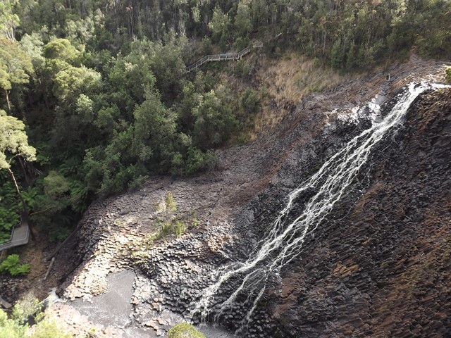
Dip Falls
A short walk to a beautiful falls over an interesting rock formation.
 200
m
return
20
mins
200
m
return
20
mins
The Big Tree
A short walk to a really large tree with a girth of over 16 meters
1.1
km
return
30
mins
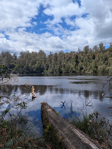
Lake Chisholm
A walk through lush rainforest to Lake Chisholm where a short loop can be walked.
2.1
km
return
45
mins
Julius River Rainforest & Sinkhole Walk
Two short walks can be walked seperately but described together here.

 2.1
km
return
1
hr
2.1
km
return
1
hr
Bluff Hill Point Loop
A lighthouse & short coustal loop with wildlife & a taste of the wild west coast.
200
m
return
30
mins
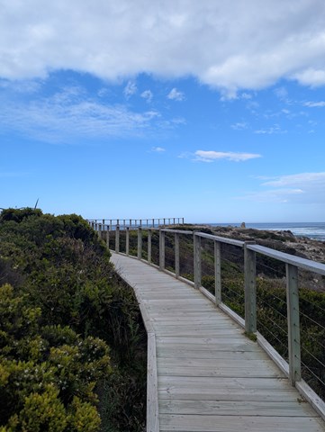
Edge of The World
A short walk on the Wild West Coast at the Arthur River mouth.
 2.3
km
return
1
hr
2.3
km
return
1
hr
Milkshake Hills Lookout & Forest Walk
A short forest loop and trail to the top of Milkshake Hills for views over the surrounding country.
1.1
km
return
30
mins
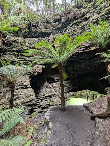
Trowutta Arch Track
A short walk to an arch & sinkhole in lush green rainforest.
 800
m
return
30
mins
800
m
return
30
mins
Pine Lake
One of Tasmania's 60 great short walks. This accessible trail offers the opportunity to see an alpine lake and pencil pines with ease.
2.3
km
return
1
hr
Hartnett Falls
Follow the trail down to the top of Hartnett Falls. From here the trail follows the cliffline downstream before hooking down to the river. From here depending on water levels you can go right out to the base of the falls.
1.1
km
return
1
hr
D’Alton and Fergusson Falls
A short side trail to D’Alton and Fergusson Falls.
2.4
km
return
2
hrs
Mount Pelion East
The far more civilised Pelion is still a worthy walk offering a lot of bang for buck. A short side trail leads sharply up the shoulder from Pelion Gap before a short little scramble up the nunatak summit.
 11.4
km
return
4
hrs
11.4
km
return
4
hrs
Mount Oakleigh
To reach the true summit of Mount Oakleigh an 11.4km side trail is required although the first East peak can be optained via a 7.8km return hike or a 9.8km return hike can be made to the commonly obtained false peak which places you above the famous Oakleigh spires.
1
km
return
1
hr
Old Pelion Hut
A short side trail to an historic hut. There is also an old copper mine and Douglas Creek just past the hut.
 5.3
km
return
4
hrs
5.3
km
return
4
hrs
Mount Pelion West
A side trail from the Overland Track that isn't listed as an offical side trail due to the extreme nature of the undertaking. This is Tasmania's 3rd highest mountain and is a substantial undertaking. The trail isn't as evident as the official side trails and once onto the summit ridge the scramble to the summit involves large chasms between boulders.
3
km
return
90
mins
Lake Will
The walk to Lake Will is roughly 3km return although if you follow the overgrown path along the edge of Lake Will for roughly 5.1km return all up you can make it out to Innes Falls.