
Menu
Popular Walks
-
Devil's Peak Trail
(5 ticks) -
Remarkable Rocks
(4 ticks) -
Prospect Hill
(3 ticks) -
Cape du Couedic Hike
(3 ticks) -
Mt Ohlssen Bagge
(3 ticks)
Summary
South Australia covering some of the most arid parts of the country.
Popular Walks
-
Devil's Peak Trail
(5 ticks) -
Remarkable Rocks
(4 ticks) -
Prospect Hill
(3 ticks) -
Cape du Couedic Hike
(3 ticks) -
Mt Ohlssen Bagge
(3 ticks)
Sub-Regions
Other Information
...
Fees/Permits
Quite a few of the national parks in South Australia have entry fees.
https://www.parks.sa.gov.au/book-and-pay
Contact details
National Parks and Wildlife Services South Australia
https://www.parks.sa.gov.au/
Walking SA
https://www.walkingsa.org.au/
Walks in South Australia

 2.9
km
return
2.9
km
return
 90
mins
90
mins
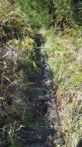
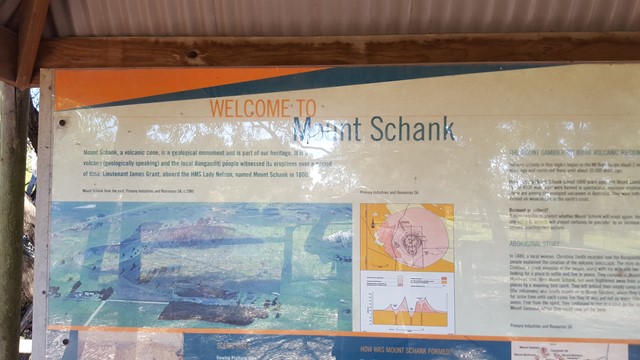
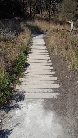
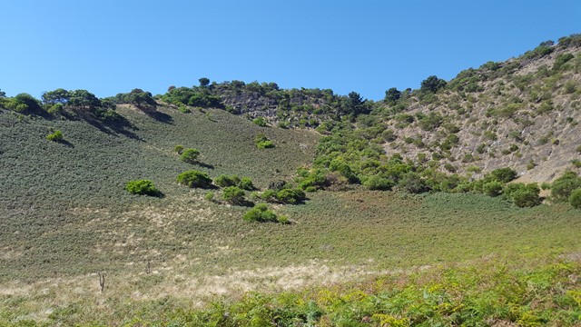
Mount Schank
Your chance to enter the centre of Mount Schank, the youngest volcano in Australia (5,000 years old) and now a 100m high dormant volcano, with a basic ash cone and base that does not extend below the water table, so there is no crater lake.

Mt Woodroffe
The tallest mountain in South Australia. Deep in the remote outback, but on APY lands so permit required. Diversetravel run an annual tour in May. No marked track, spinifex and remoteness make this a challenge.
 10.4
km
one-way
2
hrs
10.4
km
one-way
2
hrs
Oyster Walk
A 10.4km walk along the coast line at Coffin Bay, Ayre Peninsula. It is a good way to explore the township and area. A pleasant, easy walk with some special views around each corner. It can be done in sections and so the length is your own choosing.
 2.5
km
return
1.5
mins
2.5
km
return
1.5
mins
Plateau Hike
This hike begins along Fourth Creek and then ascends above the valley floor to Giants Cave. Enjoy the stunning views of Morialta Gorge from the Kookaburra Rock Lookout, the top of First Falls and Eagles Nest Lookout.
 2
km
return
1
hr
2
km
return
1
hr
Punchbowl Lookout Walk
A new trail opened in Spring 2017 as part of the Government of South Australia’s $10 million upgrade of the Adelaide’s national parks.
The 1km (2km return) trail visits a new lookout above The Punchbowl, where you can see spectacular views into the Onkaparinga Gorge. The trail is a consistent one metre wide and made of compacted gravel, and with gentle contoured gradients, so as such is suitable suitable for people of all abilities, including those with mobility access issues, wheelchairs and prams. There is some seating mid-way along the trail.
Some people using wheelchairs may require assistance on the way back up the trail to the car park.
The Hike begins from the new carpark constructed in 2017, between gates 8 and 9 on Piggott Range Road. There are toilets at the nearby Sundews Carpark, near Gate 11 on Piggott Range Road.
9.8
km
one-way
4
hrs
River Trail, Sturt Gorge
The River Trail follows the Sturt River through Sturt Gorge. It explores the rugged beauty of the river, including waterfalls, flowing creeks and rocky gorges.
The trail can be adventurous, with 9 river crossings and some rock scrambling. After rain expect the river to be higher, and the stepping-stones across the 9 river crossings may be underwater.
Begin on Main South Road and walk through Riverside Reserve, then along Adam’s Orchard Trail from the end of Riverside Drive, Bedford Park. Or begin at Edgar Street, Bedford Park. Follow the trail to the eastern end of Sturt Gorge Recreation Park, where the trail emerges on Coromandel Parade beside Horners Bridge. Built in 1886 Horners Bridge is a large stone arch bridge, and was the first bridge across the Sturt River. It was on the original Adelaide to Goolwa Road, which was superseeded when motor cars became popular (and the road unsuitable for fast travel).
The trail could be walked one-way by using Adelaide Metro public buses to return, from Bus Stop 28 Main South Road to Bus Stop 37B Coromandel Parade.
4.2
km
one-way
90
mins
Robe Coastal Trail
An interesting cliff line walk out around Cape Dombey and back to town via the Marina.
 5.3
km
return
2.5
mins
5.3
km
return
2.5
mins
Second Falls Hike
This trail has spectacular panoramic views across Adelaide and of Morialta Gorge and First and Second Falls. Enjoy visiting the Kookaburra Rock, Eagles Nest and Deep View lookouts. Rangers recommend doing this hike in an anticlockwise direction.
2.1
km
return
1
hr
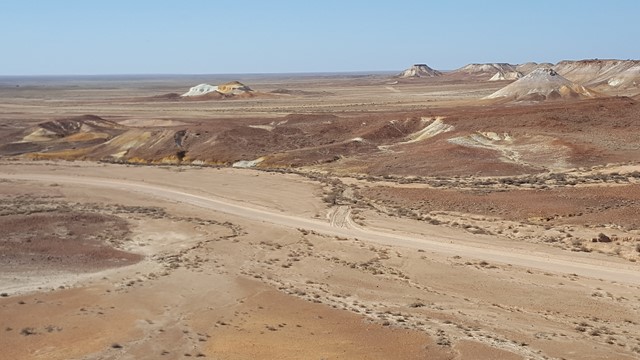
The Breakaways
Kanku – Breakaways Conservation Park consists of colourful low hills which have broken away from the Stuart Range, hence their name ‘The Breakaways.’ The two lookouts highlight the open spaces and colourful environment, leaving an impression of the long gone inland sea that our early explorers dreamt of. As the day goes by, the passing of the sun changes the desert colours, creating photogenic scenes that appear surreal.
Note that currently there are no tracks in the park and as it is a registered Aboriginal Heritage Site climbing the hills is a breach of the Aboriginal Heritage Act.
 7.3
km
return
3.5
hrs
7.3
km
return
3.5
hrs
Three Falls Hike
A hike that visits all three of the waterfalls in Morialta Conservation Park. The hike skirts around the edge of the gorge with views of the cliffs, and continues up Fourth Creek past First Falls, Second Falls (with a short detour) and Third Falls. Views back over the Morialta gorge and the Plains.
The hike begins from the top carpark, or you can commence from the lower carpark on Stradbroke Road and walk along the Fourth Creek Walk to the top carpark.