
Pages Pinnacle
South East Queensland


Menu
GPS Tracks


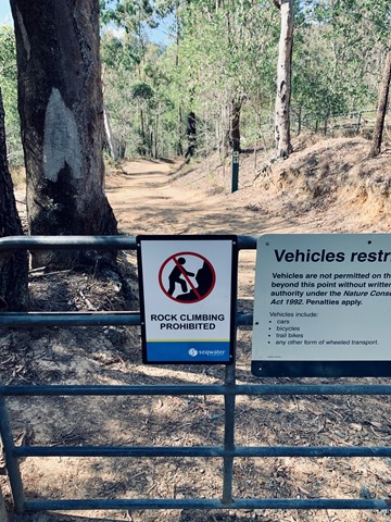

PLEASE DO NOT THROW ROCKS OR ANYTHING OFF THE RIDGE LINE!!!!!!! PLEASE WATCH YOUR CHILDREN AND TEENS ALSO AND STOP THEM FROM THROWING ANY OBJECTS OFF OF THE RIDGE. ROCK CLIMBERS ARE FREQUENTLY CLIMBING BELOW AND MANY CLOSE CALLS OF CATASTROPHIC DAMAGE HAVE BEEN ENCOUNTERED LATELY FROM HIKERS THROWING ROCKS!!!
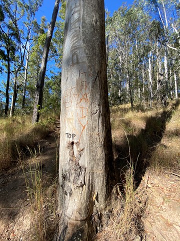
PLEASE DO NOT MAKE MARKINGS ALONG THIS TRAIL, THIS INCLUDES CARVING TREES AND PAINTING ROCKS
PLEASE RESPECT THE OUTDOORS AND LEAVE NO TRACE.
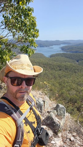
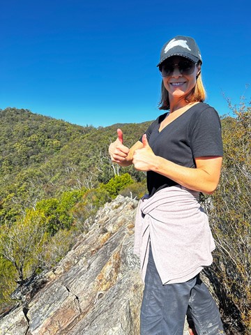
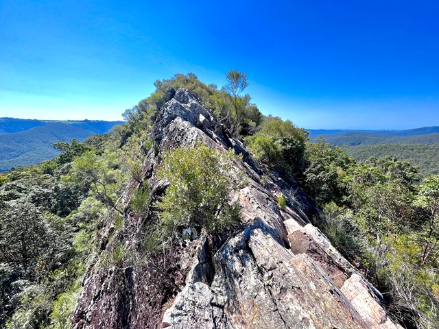
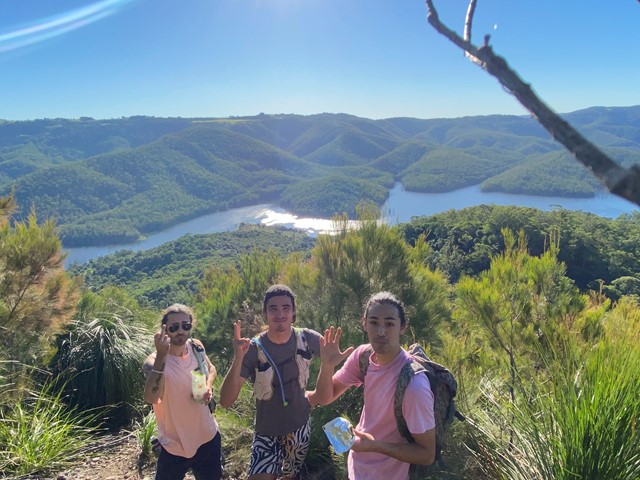
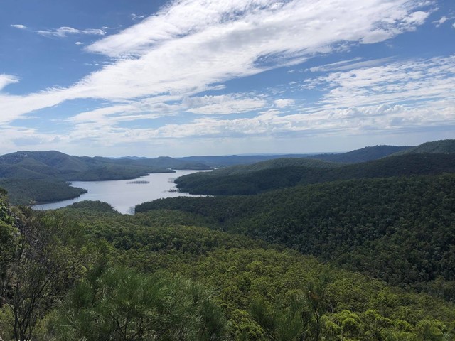
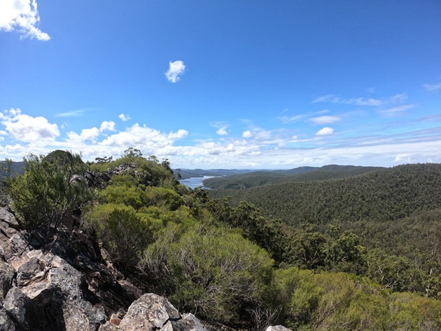
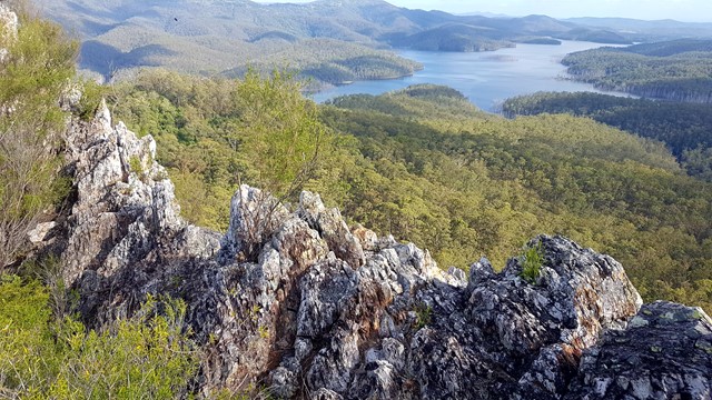
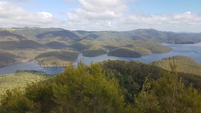
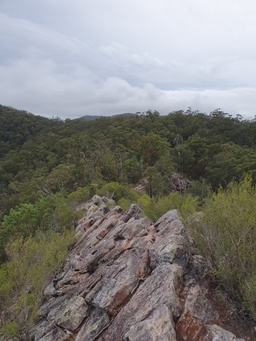
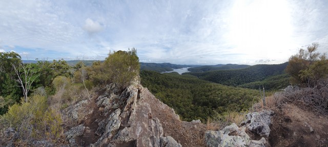
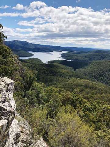
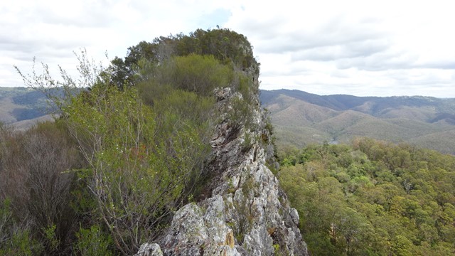
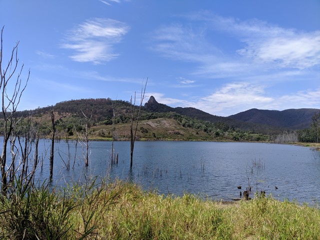
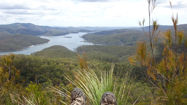
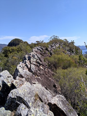
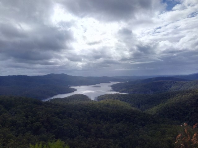
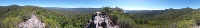
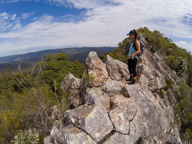
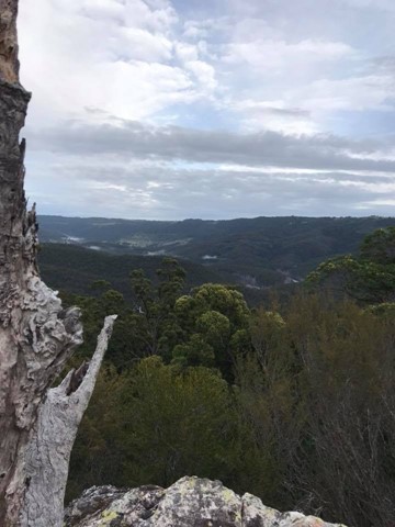
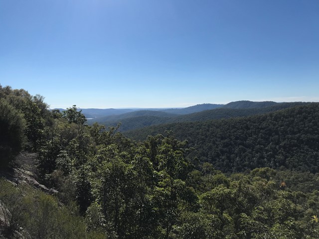
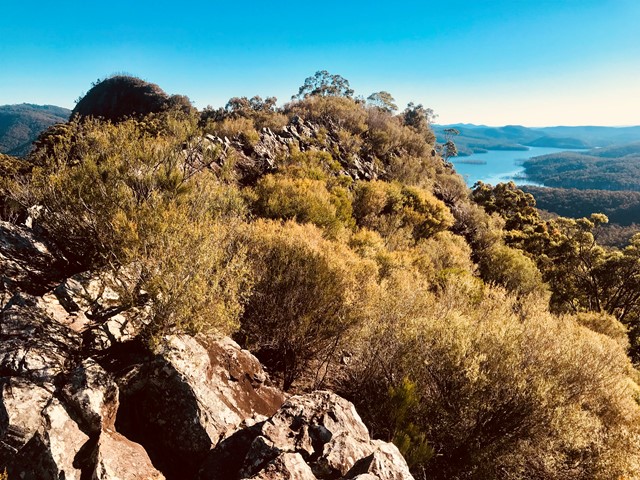
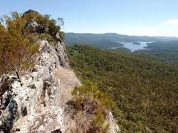
Pages Pinnacle is a 400m high tertiary rhyolite volcanic plug on a ridge between Springbrook and the Numinbah Valley. It is located above the Nerang River within the Numinbah State Forest. The Yugambeh people called the pinnacle kundohikulli meaning rock shaped boat. The pinnacle, similar to other ancient volcanic landmarks in the Gold Coast and northern New South Wales hinterlands, is an acid volcanic rock containing at least 66% silica. The view at the top of the Pages Pinnacle overlooks Hinze Dam.

Getting there
From the Gold Coast, follow Nerang Murwillumbah road and turn left onto Pine Creek Road. Approximately 2-3 kilometres after the turn-off, there will be a car park which is next to the Scouts Numinbah Camp Site.
Maps
Wikiloc
Route/Trail notes
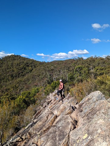
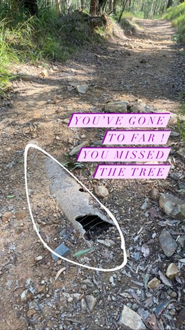
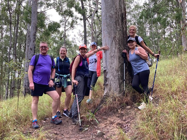
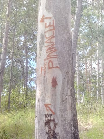
From the carpark, walk around the gate on the right and follow the fire trail. When you come to the first junction turn right. Then turn right again at the next junction, then left. You should be walking uphill for quite some time. When you see the pinnacle on your left, look for a small cairn near a large gum tree. The gum tree has 'PP' carved into it (DO NOT MAKE ANY MORE MARKINGS IN THE TREE) (ALSO NOTE there is a tree earlier on that also says 'PP' and 'NO PP - EXIT ONLY', this track goes to the base of the ridge, do not take this track). This is where you turn left to follow the track up to the ridge all the way to the pinnacle. The walk is quite steep and you my be walking with your head down so it is quite easy to walk past the tree so remember to look up occasionally.
Permits/Costs
N/A
 Pages Pinnacle (GPX)
 6.7
6.7 2.5
2.5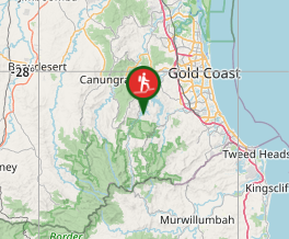
Comments