
Menu
Popular Walks
-
Castle Hill
(60 ticks) -
Babinda Boulders
(39 ticks) -
The Forts Walk
(16 ticks) -
Djyinda Walk
(14 ticks) -
Horseshoe Bay - Rotary Lookout
(11 ticks)
Parent Regions
Sub-Regions
Popular Walks
-
Castle Hill
(60 ticks) -
Babinda Boulders
(39 ticks) -
The Forts Walk
(16 ticks) -
Djyinda Walk
(14 ticks) -
Horseshoe Bay - Rotary Lookout
(11 ticks)
Parent Regions
Sub-Regions
History
Any interesting history for the region?
Features
What are the standout bushwalking features?
Access
How do you get there? Include all access points if there are many?
Maps
Which maps cover the region?
Accommodation
Where can I stay there? or near there?
Camping
Council Areas:
- Mount Isa City
- Cloncurry Shite
- Mckinlay Shire
- Richmond Shire
- Flinders Shire
- Charters Towers Regional
- Palm islands
- Hinchinbrook Shire
- Townsville City
- Burdekin Shire
Contact details
Contact details for National Park offices or similar...
Walks in North Queensland

 6
km
return
6
km
return
 2
hrs
2
hrs
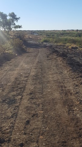
Flinders River Walk
An enjoyable walk along the banks of Station Creek and Flinders River (Queensland's longest river), with various historic attractions along the way. This is dinosaur country, so keep your eyes peeled!
 500
m
return
30
mins
500
m
return
30
mins
Horseshoe Bay - Rotary Lookout
A short 10min pathed walk through some light vegetation, past some really beautiful rocks and up to a viewing platform over Horseshoe Bay
 800
m
return
20
mins
800
m
return
20
mins
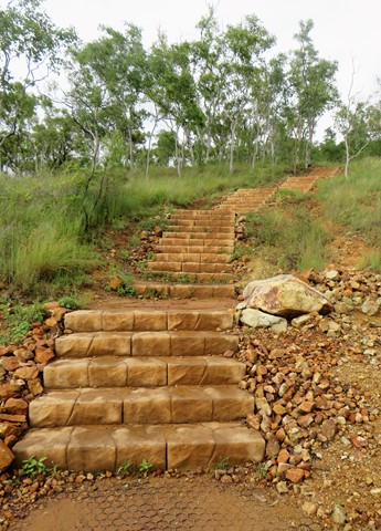
JCU Walking Track
The JCU Walking Track is a joint project of TropEco and JCU Discovery Rise. 493 well-maintained steps through beautiful bushland up to a gorgeous view of Townsville out to the ocean and James Cook University. Kangaroos, crickets and other critters are common along this enjoyable walk.
 3
km
return
1
hr
3
km
return
1
hr
Julia Creek Nature Trail
Located behind the caravan park, the nature trail offers a chance to see some of the local birds and wildlife, especially if you do the walk either in the early morning or late afternoon.
 5
km
return
1
hr
5
km
return
1
hr
Lake Ross Walk
There is a Gravel track directly next to Lake Ross where you can walk along as far as you like.
Good view over Lake Ross and the Mountains in the Background.
 3.5
km
return
1
hr
3.5
km
return
1
hr
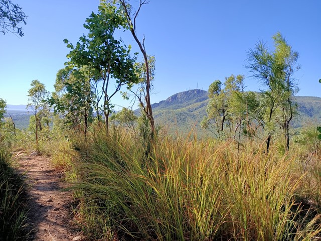
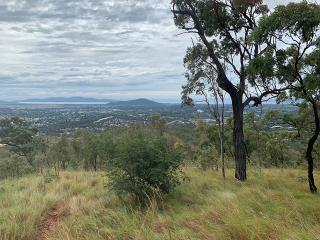
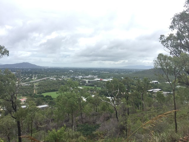
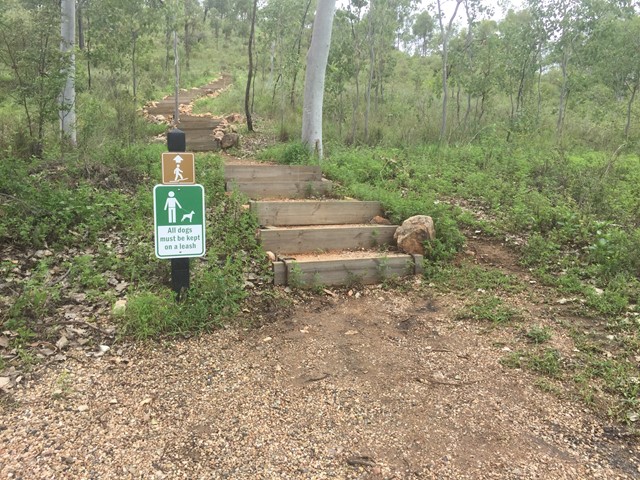
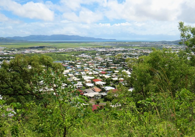
Mount Louisa Bush Walking Track
Popular walking track for fitness enthusiasts, 3.5km circuit track contains many stair climbs along the way to reach the summit and enjoy sweeping views to the north-east across Townsville and Cleveland Bay out to Magnetic Island, as well as views from the ridgeline and summit extending south-west from Mount Stuart to Kirwan.
 5.2
km
return
6
hrs
5.2
km
return
6
hrs
Mount Robert
Standing about 1000m high, Mt Robert, in the Boyne Valley is the highest mountain between the Gold Coast and Townsville. The Boyne Valley is a rural locality in Gladstone Region, Queensland, Australia. Mt Robert is situated on private property therefore can only be climbed when the family allows access usually once a year around July.
 15
km
3
hrs
15
km
3
hrs
Mount Stuart
15km return walk from the steep roads ahead sign. 7.5km of continual uphill then 7.5 back down. There are no tracks available to the public so you need to walk up the narrow road.
600
m
return
1
hr
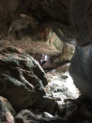
Pompeii Cave
Pompeii Cave can be accessed from the Donna Cave car park, 1.8km south of Chillagoe. From the car park, a well-formed track with many steps leads through deciduous vine forest to Pompeii Cave—a cleft in the rock filled with large boulders, the remnants of a previous collapse.
Inside this small cave, look for bats sleeping high in dark crevices and rock-wallabies hopping from boulder to boulder. A short but steep climb to the bottom reveals a dark passage and some attractive formations. Be careful not to walk on or touch cave decorations such as flowstone or cave coral. Torches are required.
 500
m
return
45
mins
500
m
return
45
mins
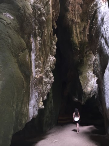
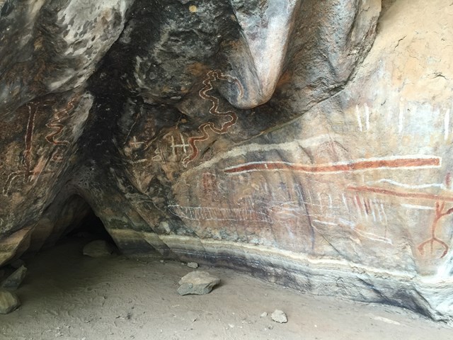
The Archways
The archways walk is spectacular, with narrow passage connecting larger caverns. You'll want to take the most photos at the Art Site and the end of the Archways walk.
NOTE: There are bats in the archways. There is one small hole you are required to crawl through however there is daylight on both sides.