
Goat House Cave
Lord Howe Island


Menu
GPS Tracks
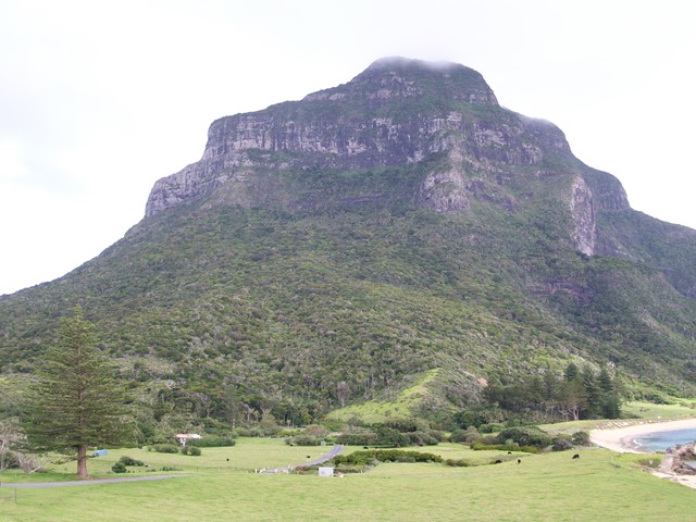
A steep climb through wet rainforest till you reach the cliffs of Mt Lidgbird at 400m and to your left is the large volcanic cliff overhang know as Goat House Cave, with its spectacular views of the settlement on the one side and Ball's Pyramid on the other.

 Getting there:
First you have to get to Lord Howe Island! Direct flights are available from Sydney (most days) or Brisbane (weekends) and your accommodation on the island must be pre-booked, as only 400 visitors at any one time can be accommodated. You will need a week to fully enjoy what this wonderful paradise island has to offer. Or you could arrive by boat!
From then on, everything is by bike (or walk), which you hire from your accommodation.
From your accommodation head out towards Mt Gower on Lagoon Road and 400m beyond Capella Lodge, you will see the start of Smoking Tree Ridge Track on your left (signposted).
Maps:
Lord Howe Island Walking Tracks
Island maps are available from your accommodation or the Information Centre/Museum on Middle Beach Road.
Route/Trail notes:
Head up along Smoking Tree Ridge Track for 1km to the saddle between Intermediate Hill and Mt Lidgbird. This section is an easy climb at 1/10. At the saddle continue on Smoking Tree Ridge Track as it turns right and continue upwards towards Mt Lidgbird. This section is steep at 1/4, till you reach the cliff face and go left around to the overhang (Goat House Cave) and the ledge beyond. Ropes have been provided in places to aid your safety.
Return by the same route.
Permits/Costs:
None.
Other References/Comments:
Take a picnic, your binoculars, swimmers and a towel, as on this island, you are never too far from a beach to cool off on after your walk. Oh, and always have some bread to hand feed the fish.
Track notes for Goathouse Cave via Intermediate Hill
 7 Goat House Cave (GPX)
 4.6
4.6 3
3
Comments