
Basin Loop Track
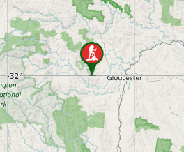
New South Wales


Menu
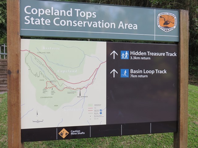
This track is an extension of the Hidden Treasure track, if you would like a more strenuous, longer walk.

Getting there
The Copeland Tops picnic area is 18km from Gloucester. Take the road towards Scone and then the turnoff to the village of Copeland. Follow the signs to the picnic area.
Maps
Which maps cover the area?
Route/Trail notes
Begin the walk at The Copeland Tops Picnic Area. Walk up the hill and when the track branches to the left, take this path to walk through the hidden treasure track first. Follow the track to the left again when you reach an intersection, as otherwise you may miss the mine. You will come to an intersection where there are options to go back to the car park or to complete the Basin Loop Track. Take this path which will take you up the hill. Some parts are quite steep and a little loose. You will come to a NPWS service 4wd track. Turn right here. It will take you up to the road. Turn right again, and shortly you will see another service road to the right that will take you back down the hill along the old Copeland Rd.
Permits/Costs
No cost
Other References
How can I find more info? Any guide books?
GPS Tracks
- No GPS available for this walk yet.
 7
7 ??
??
Comments