
Mt Murchison
West Coast Tasmania


Menu
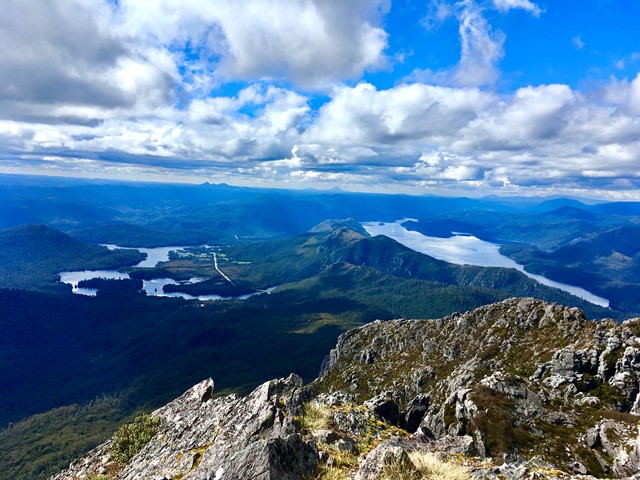

A steep narrow track up firstly then you hit the plateau to then finish off over the boulders to the summit
Lookouts
Scrambling or Climbing
No Rainforest
Swamp or Wetland

Getting there
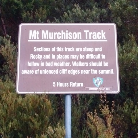
When heading out Tullah towards Roseberry head for Anthony Rd ( link Rd to Queenstown ) follow that for a good 5km or so.
You wil notice a sign when aproaching the track with a car park on the left and the track on the right.
Maps
Tas Parks
Route/Trail notes
Steep , rocky , boulders to scarmble over but you'l have a breather in bewteen when reaching the plateau at about 800m
Permits/Costs
Unsure !? I had a park pass as I was in Tasie visiting multpile parks
Other References
How can I find more info? Any guide books?
GPS Tracks
- No GPS available for this walk yet.
 3
3 5
5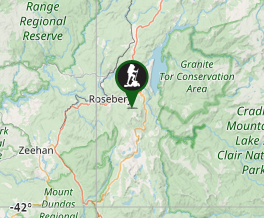
Comments