
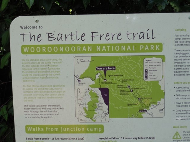
Mt Bartle Frere - Western Approach
Wooroonooran National Park


Menu
GPS Tracks

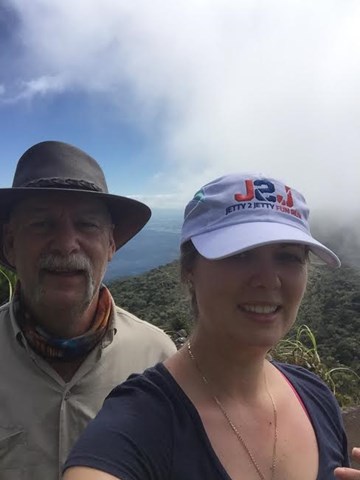
Climb to the summit of Queensland's highest mountain (1,622m) provides a challenging way to explore this part of the World Heritage-listed rainforest of the Bellenden Ker Range. This is not a race, so allow yourself two days to walk (recommended), climb and enjoy this trail. The fabulous summit views include the township of Innisfail and the coast to the east, and to the west, the undulating landscape of the Atherton Tableland.

Getting there:
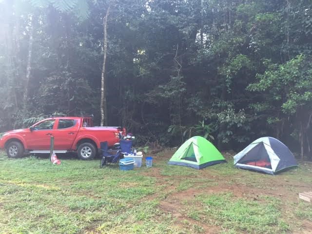
This is a challenge in its own right and unless you camp at Junction Creek the night before you climb, you should not attempt to complete the climb in one day.
About 5km east of Yungaburra on the Gillies Highway, turn at the Gillies Roadhouse into Lake Barrine Road and follow this road for 6.3km before turning left into Topaz Road. Follow this road for 19.5km before turning left onto the dirt track of Gourka Road, which you follow for 9.7km to Junction Camp. Gourka Road is 4WD only unless very dry.
Due to the nature of the Gillies Highway (includes 20km of very twisty uphill driving - known as 'crash alley!), this would be over two hours' drive from Cairns (84km).
Atherton and Yungaburra both have a selection of accommodation options and there is a camp site at Eacham Lake, which is signposted off Lake Barrine Road.
Maps:
Route/Trail notes:
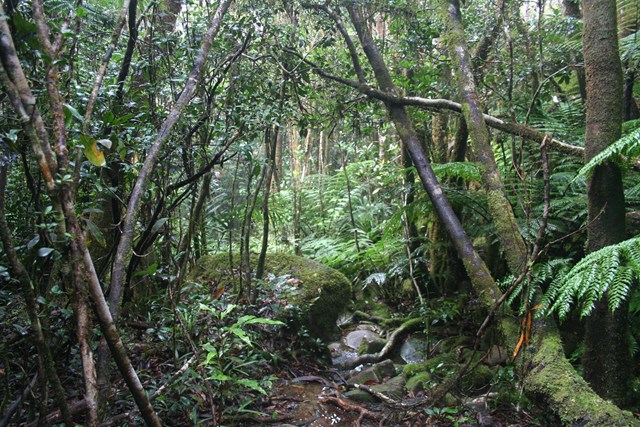
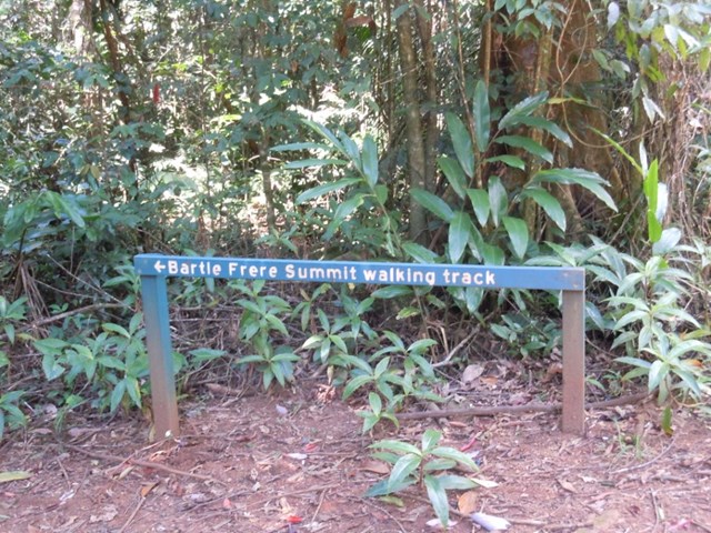
The trail starts at 700m and rises to 1,622m, but the first 2km are pretty flat and it is only at this point that the real climb begins. Orange reflectors have been placed on trees to mark the track, as well as painted arrows on boulders. Where there are gaps, kind fellow bushwalkers have added pink flagging tape.
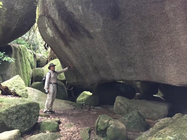
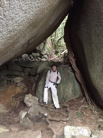
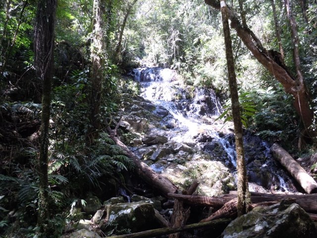
Junction Camp to North West Peak (3.5hr, 5.3km) - a short distance (1.75km) from the start, is a turn-off on the left to the picturesque Bobbin Bobbin Falls. The trail to North West Peak is steep, rising 700m over 3.5km. This part of the trail has occasional rock/boulder scrambles and long sections of continuous uphill walking. in places, you climb under the granite boulders.
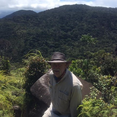
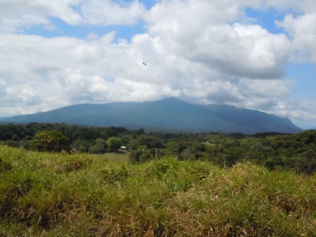
North West Peak to Western Summit Camp (1.5hr, 2.2km) - on a clear day you can enjoy excellent views of Bellenden Ker Range and the Mulgrave River valley from an exposed outcrop of rocks .5km from North West Peak. The trail continues to Western Summit camp, which is a very small clearing beside a creek, where you can camp overnight (room for 4/5 two-person tents), replenish your water supply or as a resting point before you climb to the summit.
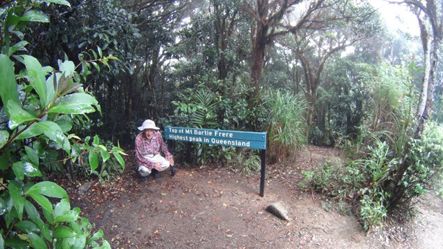
Western Summit camp to Bartle Frere summit (1hr, 0.5km) - the trail becomes a scramble over and through numerous granite boulders to the broad summit of Bartle Frere. This part can be very slippery when wet. If camping at Western Summit, then an early start can provide a spectacular sunrise from the top.
From the summit you can return the way you came, or continue down the Eastern Approach to Josephine Falls.
Permits/Costs:
There is no costs unless you camp, in which case there is a small fee to pay, which can be obtained online from National Parks. See link below.
Other References/Comments:
The Bartle Frere trail is not for everyone. Walkers have been lost for several days in the area, despite widespread searches. You need to be well prepared and responsible for your own safety. Although the trail is well marked, it is unformed and very steep; walkers being prepared for rock scrambling in places. Only experienced and fit bushwalkers should attempt this trail.
Always let someone know your plans and when you expect to return. In the event of an emergency, satellite phones and personal locator beacons (PLBs) are the most effective, as mobile phone coverage is unreliable. Always carry a torch or headlamp.
There is guaranteed clear cold water supply at Western Summit Camp, but you should still carry at least 3lt supply each with you.
Leaches can be a problem and you need a suitable repellent. Apparently once over 1,000m the numbers thin out considerably!
 Mt Bartle Frere Western Down (KML)
 16
16 12
12
Comments