Mt Eerwah

Sunshine Coast

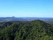
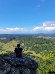
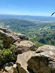
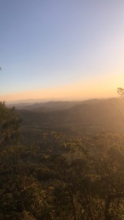
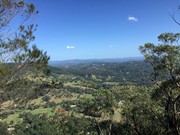
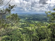
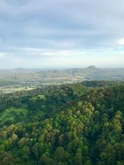
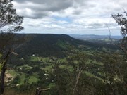
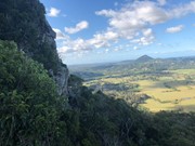
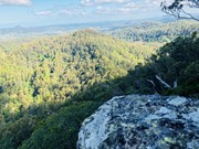
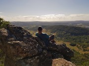
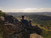
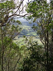
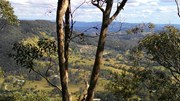
This is a seldom but fun mountain to climb and in places only has a faint trail to the top. Views from there are in a westerly direction and whilst spectacular, the views to the east across the coastal plain, would have been even better, but for the scrub and trees.

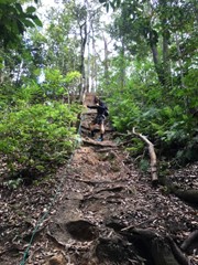
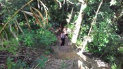
It's a steep and loose track, definitely not suited for those with balance issues, smaller children, etc. A section near the top has eroded/wasted away, leaving a significant drop off - be careful!
The track is very clear. At one point the description on this site indicates to turn right upon reaching a ridge. I think that’s a typo as the track continues up to the left.

Scrambling or Climbing
No Dogs Permitted
No Camping Permitted
Rainforest
422m
Maximum Elevation
294m
Total Climb

Getting there:

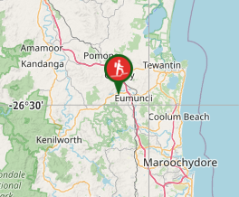
From the Bruce Highway, take the Kenilworth/Noosa exit; follow signs towards Kenilworth on the Eumundi Kenilworth Road; turn left into Browns Creek Road and then left again into Mt Eerwah Rd. After 0.5km at the letter boxes 75 and 79, there is a spot on the left to park 3/4 vehicles (at the beginning of the bamboo hedge) and it is here that the walk begins, even though the mountain is on your right.

Maps:

None found.

Route/Trail notes:

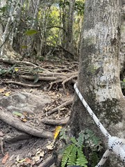
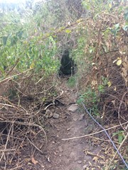
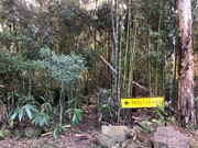
At the start of the track there is a roadworks sign that says “Pedestrians” which point to the start of the track. Follow the fence line across three gullies, the last of which has been kindly roped. A faint trail contours around some open land until it reaches a ridge that you turn right onto. Now follow the ridge up where the trail threads through some rather large lantana patches. 1/3 up, you can take either the right and left trail, which converge after 100m at the top of a rocky gully.

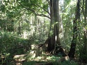
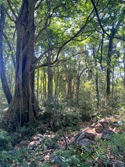
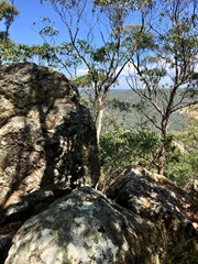
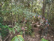
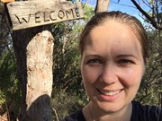
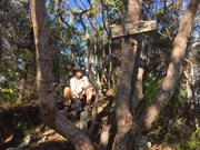
Follow through the rainforest where the path is steep, slippery and loose. Once you leave the forest, after a few twists and turns above the cliff line and a further roped (broken 2017) section where the trail is narrow, you will reach another steep, loose slope that will get you to the summit ridge. Once the ground levels out, follow the ridge uphill and down dale to the 'true' summit. At the 'welcome' sign, enjoy the view, a drink and a bite to eat.

Retrace your steps back down.

Permits/Costs:

None.

Other References:

Climb Mt Eerwah

The word 'eerwah' is apparently the indigenous work for 'death adder'. So watch out!

I have read that you can continue beyond the summit, down and back up to the second summit to the south east, but I understand this would take you onto private land.

GPS Tracks

Comments

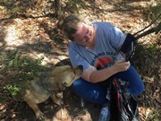
Challenging but very rewarding incline with some rock scrambling. I went at 7am on a Sunday first to arrive. Carpark has enough room for about 4cars. I had the privilege of the local red dog from the house across the road guide me all the way to the summit and back down again. He’s very friendly just wants someone to walk with him. There’s ropes at numerous locations along the climb to help with the steep muddy areas. Overall one of my favourite hikes. Peaceful with amazing views along the way and at the top. If you do go with red dog he’ll want to take you to the 2nd summit. It goes downhill to get there.

RJP on 14 Apr, 2024

Unrelenting but rewarding. Glad I wore suitable footwear and glad the temperature wasn’t hot. The red dog was in attendance and was quite vocal!

Adrienne on 9 Jul, 2023

Thanks to whoever put all the ropes up for this climb, really helped in the steep, slippery parts! A short, sharp one to get the heart pounding. Took 2 hours return with lots of stops to catch my breath on the way up! No sign of red dog!

Sonja Wentzel on 26 Jun, 2023

Nice walk. Pretty steep

Lukas on 12 Mar, 2023

Love this hike, this is my third time here
Love that local dog, lead me to the summit again.

Leo on 10 Feb, 2023

Second time up, Decent hike
Steep incline all the way to the top
Hiking stick’s recommended
It’ help you going up, and save your knee going down
Took me 1.45hr to the second summit
Met lovely local dog too, guided the way

Leo on 26 Jan, 2023

Very steep hike all the way to the top

Lucky we got the local dog to guide us the way to the top
and back

Not much view at the top tho, lots of trees

Fun climb

Leo on Dec, 2022

Good work out on this mountain, it took us 4 hours round trip which was to the summit lookout which has terrific coast views
Harder than Cooroora I think, but great fun. As mentioned good shoes are handy as its very steep & slippery in many places

Bribie 61 on 22 Aug, 2021

So much fun solo hiking this beauty. As always, if you're going on a weekend, be sure to go early to avoid the peeps. (I actually started a bit later this time, at 7am, and still only passed about 3 people, but when I got back to the bottom they were piling in).

The first ascent to peak is very steep. Not too much of a view at the first peak.

Keep going, it's bloody worth it. You'll start declining as if you're heading down the other side of the mountain. You'll pass through gorgeous rainforest-ish area before beginning the second ascent, which is barely an incline. You will pop out the other side of the scrub and voila, possibly the best view on the coast. Yewww beautayyy.

I spent 2.5 hours including hiking, exploring around and looking up in awe of the beautiful, huge, old trees.

Not a Sunday stroll in the park - it's quite strenuous so if that's what you're into, this is the hike for you. Big love.

TheImperialHiker on 15 Aug, 2021

This walk can be quite challenging at times. when at the top there are majestic views of point glorious to the west, mount Cooroora, mount pinbarren, and mount Cooroy, all to the north. If it is a clear sunny day you can even spot lake Wayba and Noosa heads to the east. to access the mountain you must exit the bruse Highway, at the roundabout take the third exit onto Eumundi- Kenilworth road. turn left on to brown creek road, then turn left on to Mount Eerwah road. when you get there there will be a sign saying, pedestrians.

de_hiker on 30 Nov, 2020

Directions to start of walk are good as per previous comments. The trail is generally easy to follow. It is very steep as described.

Importantly, there are two peaks to the mountain. It is about 45min to the highest point of the walk. You can continue along this ridge for about 10 minutes. Views to the west here only. At the most southerly point of the ridge, the trail heads down again. It is from here that you can continue the walk for an additional 30mins to the second summit. This is where the trail is quite faint and hard to follow. Staying on the ridge is the main idea. It is lovely and through a rainforest section, before climbing up to a final rocky outcrop with a vantage point to the north-east. This is the best position of the climb and would recommend.
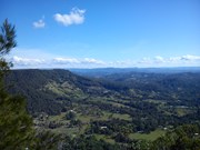
My advice is to mentally prepare yourself for the two summits, rather than thinking it's over at the first.

All up spent 4 hours.

ct__ on 30 Nov, 2020

Great little hike, the trail is beautiful and well travelled so easy to follow however its quite narrow and steep in most parts so deff need good shoes and a bit of fitness under your belt.

MELG on 22 Aug, 2020

did this today in the most spectacular of weather .. we are hikers and its definitely a heart starter and we think a little tougher than Mt Corooroora and Mother Mt .. saw 4 groups, 1 didnt make it all the way the others made it to the top.. wouldnt do this after wet weather but a fun and leg/calf burner walk and nice core work out on the way down keeping yourself centred with the gradient.. track is clear and really easy to follow no need for instructions other than the trail head... wanted to post to share the elevation as there was some questions here my partners Garmin said it was a 400m climb from the carpark! who knows but its a guide

Tjac on 16 Aug, 2020

i live right next to the track to the mountain so i often see people climbing up and down this gorgeous mountain. I’ve lived here my whole life and i climb this mountain almost every week. For anyone who has climbed the mountain, you may know my house by the sounds of chickens, dogs barking or goats. The chicken pen is visible from the top of the path near the end of the fence and top of the rope climb. This is one of the best mountains around in my opinion (probably just because i live here). I actually climbed it today and went past a group of 4 walking down. My sister and i were the last on the track and stayed to watch the sunset. It’s an amazing mountain though the track has gotten more eroded over the years. The track has become quite popular though many people still don’t know about it which i’m glad about. I like having this track to myself a lot because i can take in the views and not be disturbed by heaps of tourists. Though i do love meeting new, friendly mountain climbers each time i go up. 10/10 rating from me.

hayley on 7 Jul, 2020

This is one of the most fun walks I have been on out of the 7 Mountains I have climbed around the Sunshine Coast. Mt Eerwah is unknown by most tourist which makes this a perfect climb for people who don’t like crowds. Very steep climb with lots of scrambling up on tree roots most of the way up the mountain, the hike takes you through dense rainforest and up the first point of the mountain. I would highly recommend this climb ( It not suitable for young children due to the terrain). De finally a challenge

Adventure1234567 on 28 May, 2020

Climbed Monday 11 May 2020 with Suzy. Saw Dave & Tammy there as well. Beautiful weather conditions with a great temperature. Dry. Climb is difficult but fun. Need to watch yourself on the way down. Only did the first peak. The 'welcome' sign at the top is gone. The dogs are not allowed to go with you anymore, which I think is a shame. Views not great from the top; however, would recommend all the same.

Nick.b on 11 May, 2020

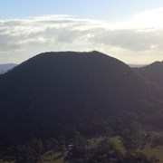
What a fun climb! Definitely a leg burner but it’s a short climb up. We loved the scrambling! Not sure if we took the right path at one stage as the track became difficult to navigate, with nothing but sand and leaves and no tree roots or trees to hold. The way we came down seemed much easier!
Whicheverway on 5 Jan, 2020

Great walk with friends. The track is pretty defined and ropes in good condition. Popular on the day with a group of 8 passing us at the top and then a couple. Friendly neighbour dogs kept us company - Rusty and Charlie.

Sheridan on 27 Sep, 2019

Had some friendly pups to guide us the way up.

JayWalker on 25 Sep, 2019

Was a very slippery, wet climb into the cloud due to having lots of rain in the weeks prior.
Thankful for the ropes still available to use on some sections of the climb. Disappointed to see the welcome arch at the start of the track and the welcome sign at the top, had been removed. (Think they were replaced by a big, old brown goat that called out several times at the start and finish of the climb) :)

julieo on 29 Jun, 2019

Where

Click here to load this map.

Nearby Walks

Done this walk?

This walk has been ticked 132 times

Aussie Bushwalking can keep track of your bushwalks.

Login/signup to tick this walk off.

Tick walks to keep track of where you've been. You must Login to tick walks. Accounts are 100% free so sign up if you don't have one.