


 103 Kenilworth Bluff (GPX)
 6
6 4.5
4.5- Cambroon Lane to Charlie Moreland Camping Area (Conondale National Park)
- Sunshine Coast Great Walk - North to South - Gheerulla Camping Area to Baroon Pocket Dam (Mapleton National Park)
- Fig Tree Walk (Conondale National Park)
- Gheerulla Valley Circuit (Mapleton National Park)
- Imbil Brooloo Rail Trail (Sunshine Coast)
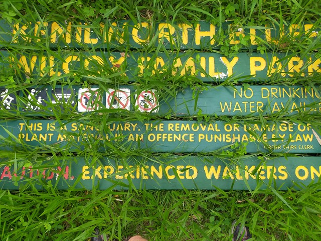
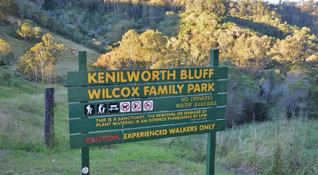
Kenilworth Bluff - Wilcox Family Park Trail
Sunshine Coast
Menu
GPS Tracks


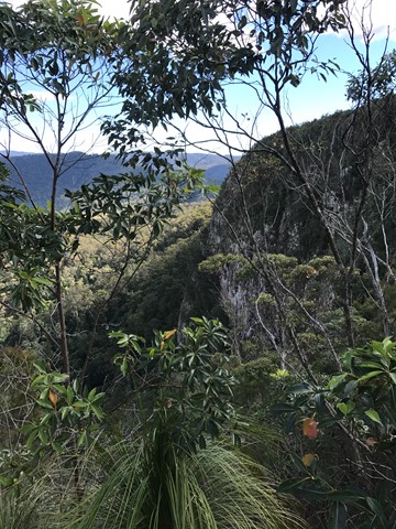


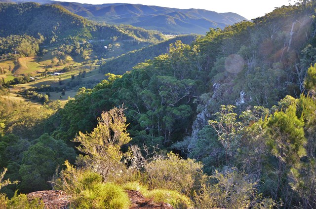


A seldom used trail through a mixture of woodland and rainforest to the top of the bluff. Make your way up and across to numerous lookout points with spectacular views..
Lookouts
Bird Watching
Picnic Facilities
Scrambling or Climbing
No Dogs Permitted
No Camping Permitted
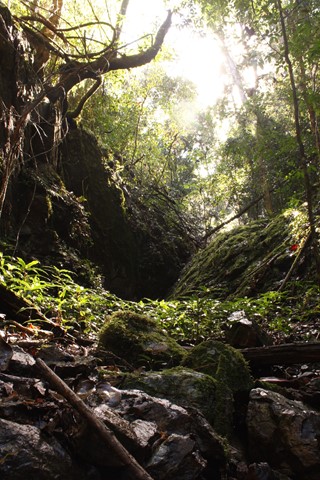
Rainforest
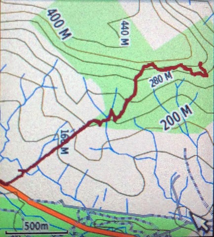
450m
Maximum Elevation
322m
Total Climb
Getting there:
The entry is marked on the right, 6kms north of Kenilworth on the Kenilworth Brooloo Road. There is a small pull-in area for cars just beyond the signage 'Kenilworth Bluff - Wilcox Family Park'.
Maps:
None found.
Route/Trail notes:
Join the track at the sign, through the gate and follow the fence line between two paddocks and past a few farm buildings. 330 earthen and hardwood-retained steps lead upwards; they call this the 'stairway to heaven' and was built under a Work For The Dole scheme. At the top is a good resting place with a couple of picnic tables.
From here, the track descends to the creek. There are trail marker posts and pink flagging tape has been added for clarification. Follow the creek left for 50m before turning right up the far side or scramble straight across and up. The track continues to the cliff face and travels right around the base. Care needs to be taken, as the track has been washed out in places.
The climb now becomes more vertical, involving “scrambling on small rocky outcrops and gripping sapling trunks to haul up on”. The plateau is several kilometres long with Mount Bunoum at 606m being the highest point. There is a waterfall area about 1km to the west.
Retrace your steps to return, although apparently there is another way down that cuts the original track, but no details have been provided.
Permits/Costs:
None.
Other References/Comments:
Times and distances vary from person to person depending on how much exploring you do on the plateau or return via the western ridge.
This is Bellbird country and can be almost deafening at times.
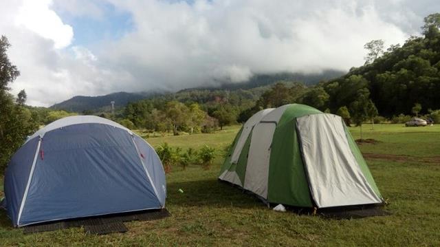
There are a number of local campsites in the area.
GPS Tracks
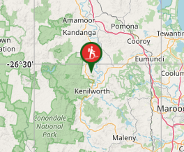
Where
Click here to load this map.
Comments