
Mt Lindesay
Mt Barney National Park


Menu
I've revised the description and left the original below.
From the border gate the route follows the western ridge before traversing the mountain's southern slopes. Once you reach the eastern ridge, look for the ascent point for the lower cliff-line, very close to the ridge crest. The climb starts with a steep chimney to a tree, which can be used as an anchor for this lower pitch if needed, then briefly traverses right before climbing straight up a very shallow gully to a ramp trending leftwards. Casuarina needles make this section slippery. The route is easy to follow from here but the upper cliff-line, while short, contains a slightly overhanging move and some climbers will require aid to ascend. It is far easier to abseil down the upper cliff-line, and safer to use a rope for all exposed sections. Rope doubled-over slings around trees, with separate sling retrieval line should work OK for descent, though the lead climber would need to be able to ascend without protection and the lower cliffs would be 2 pitches long. There were no views from the summit when I climbed this in early 2000s
ORIGINAL DESCRIPTION
This walk starts near the border gate and eventually becomes very steep on a relatively poorly defined path. It's possible to go nearly all the way to the top without a rope.

Getting there
How do you get to the start of the walk?
Map
Mount Lindesay
9441-31
C.M.A. of N.S.W.
Route/Trail notes
The Bushwalker's Guide to South East Qld by M.Hammond ; T.Young
published by the Brisbane B.W. Club
Ed3 1973
Bushpeople's Guide to
Bushwalking in S.E. Qld
ed2
Mt. Lindesay-tourist route
rockclimbing.com
The Mount Barney Guide
U.Q.B.W.C.1977
Permits/Costs
Do you need any permits? What's the cost?
Other References
How can I find more info? Any guide books?
GPS Tracks
- No GPS available for this walk yet.
 6
6 4
4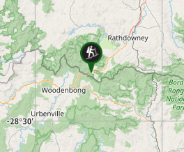
Comments