
Mount Stuart
North Queensland


Menu
15km return walk from the steep roads ahead sign. 7.5km of continual uphill then 7.5 back down. There are no tracks available to the public so you need to walk up the narrow road.

Getting there
Turn off Stuart Drive into Mount Stuart Road. There is a clearing near a sign saying 7.5km of winding road ahead. If you walk right from the bottom of the road near the Highway the walk is 18km return.
Maps
Any Townsville Map
Route/Trail notes
The walk is all on the road and takes you up and over the foothills of Mount Stuart right up to the towers. At the top the is a small track called the Loop Trail.
Permits/Costs
Nil
Other References
Information Centre
GPS Tracks
- No GPS available for this walk yet.
 15
15 3
3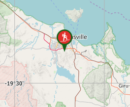
Comments