
Wilson's Peak
Main Range National Park


Menu
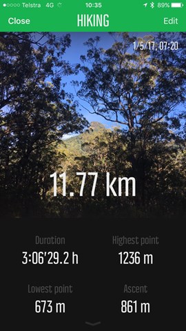
GPS Tracks


Follow the Qld/NSW rabbit fence to a peak that straddles the border (similar to Mount Cougal)

Getting there
From the Boonah-Rathdowney road, turn onto Carney's Creek Road. Follow it all the way to the rabbit fence. Where the road meets the rabbit fence there is a little area to the right where you can park your car facing East. If you hit the Boonah Border gate and cross into NSW, go back into Qld by about 1 km)
Maps
There is no real need for a map, just follow the rabbit fence to just short of the summit.
Qld Sunmap doesn't list the walk as a trail. The map shows a cliff at a steep climb halfway up the mountain, though shows just steep contours at what is really the cliff at the final section near the peak
Route/Trail notes
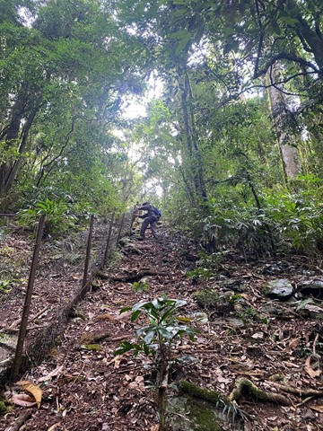
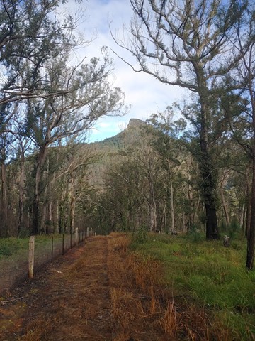
The navigation of the route is quite easy. Start walking with the rabbit fence on your left. The first few kilometres go undulate, sometimes rather steeply, along a fire trail. You eventually start getting views of Wilson's Peak before the track leads into thicker rainforest.
DO NOT ATTEMPT THIS WHEN THE TRACK IS WET! We did, going against the warnings from my guide book, and it was a horribly hard walk. Once the rainforest has been entered the track becomes extremely steep and slippery with only unreliable loose rocks and roots to grab onto, or the barbed wire rabbit fence. We spent most of the time falling or controlled sliding.
Once you've entered the rainforest, keep following the rabbit fence up and up. Eventually the fence gets mossier and loses the barbed wire, and crows nests start growing along the trees and rocks.
The first cliff area the fence continues but you'll need to head left of the fence about 50m and through another fence and then immediately up to join back to the rabbit proof fence. Don't take the lower cliff as it's very exposed
Eventually you'll get to where the fence finishes and is anchored into the cliff face itself. Any rabbit that has gotten to this point deserves to get across the fence (in my opinion).
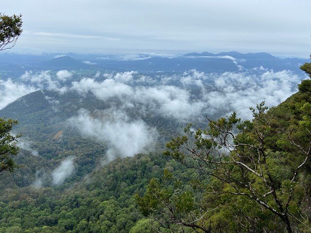
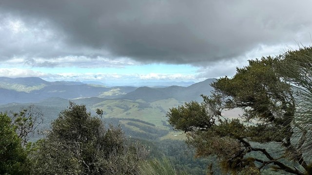
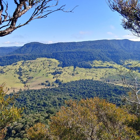
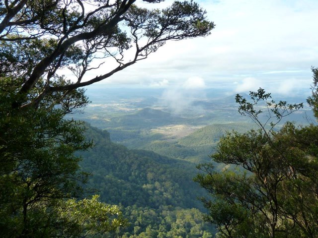
To the LEFT of the cliff face, there is a very small path that should be easy to follow. If not, just start walking with the cliff face constantly on your RIGHT. After approximately 10-15 minutes (it took us a while because of the rain and wind) you will see a track that leads up to the summit. Follow this up, over the well worn tracks through the tea trees to the peak. The peak is amongst the trees, but there is a survey marker and a cairn at the point. From the cairn, walk along a track 15 metres towards the Queensland side, where you can sit and enjoy the view before heading back down the steep and slippery descent.
Permits/Costs
None
Other References
We grabbed this one from "Take a Walk in South East Queensland" pg 280
 Wilsons Peak 03 September 2020 (GPX)
 12
12 5
5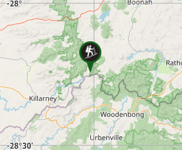
Comments