


 Ironbark Track (GPX)
 6
6 2
2- Frilled Neck Lizard Circuit (White Rock - Spring Mountain Conservation Estate)
- Spring Mountain (North) (White Rock - Spring Mountain Conservation Estate)
- Spring Mt Caldera (White Rock - Spring Mountain Conservation Estate)
- Spring Mountain (White Rock - Spring Mountain Conservation Estate)
- White Rock Ridge Hike (White Rock - Spring Mountain Conservation Estate)
Ironbark Track
White Rock - Spring Mountain Conservation Estate
Menu
GPS Tracks


Ironbark Track is an old lumber road turned into a hiking track. It cuts behind Springfield Lakes to the edge of Spring Mountain Forest park.
Eucalypt Forest
136m
Maximum Elevation
220m
Total Climb
Getting there
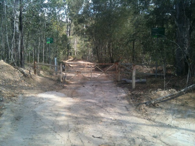
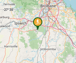
The trail head for the Ironbark Track is off of Springfield Beaudesert Connection Road. It is concealed by overgrowth.
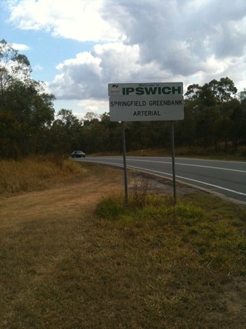
Coming from Greenbank: At the far end of Greenbank Military Camp there is a "Welcome to Ipswich" sign on the left side of the road. The parking area and trail head are about 10 meters before this sign.
Coming from Springfield: After you pass the last set of stop lights at Grande Ave, the road curves right, then left and then right again. There is no sign, but at the end of this last right-hand curve, on the right side of the road is a small trail to the parking area. (Google maps now has it: 'Ironbark trail conservation' estate is the trail head)
You can also start at the far end of the trail at the end of Huntingdale Drive in Greenbank, but there is limited space to park.
Maps
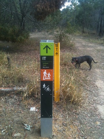
The following map contains most trails listed in the White Rock/Spring Mountain area. This trail is marked as IT on the map.
https://www.ipswich.qld.gov.au/__data/assets/pdf_file/0011/24410/White-Rock-Spring-Mountain-Conservation-Park-Guide.pdf
Route/Trail notes
WARNING! The trail is used by Ipswich Council as a shortcut, and as such, sometimes has vehicle traffic. I only found this out because I was walking, staring at the scenary to the side when I looked forward and saw a 4x4 headed straight towards me. They weren't traveling fast, but its something to be aware of if you're not paying attention or are wearing headphones.
NOTICE! The trail posts are marked wrong. They state the track is 4 km return, but that is based off of straightline map distance, not actual walking distance. Measured with my GPS, the track is actually just over 6 km return.
Starting at either end of the track will take you through the bush behind Springfield Lakes. The trail is very wide along the entire length, approximately the width of a narrow road. Within the first kilometer, the trail links up to the Frilled Neck Lizard Circuit for about 500 meters.
Every time I have walked along this track, I see multiple Eastern Grey Kangaroos. The trees are always alive with many birds and there are a few man-made objects hidden along the sides of the track, including a chopped up 1974 Holden as well as a wooden bridge that appears to be 75 to 100 years old.
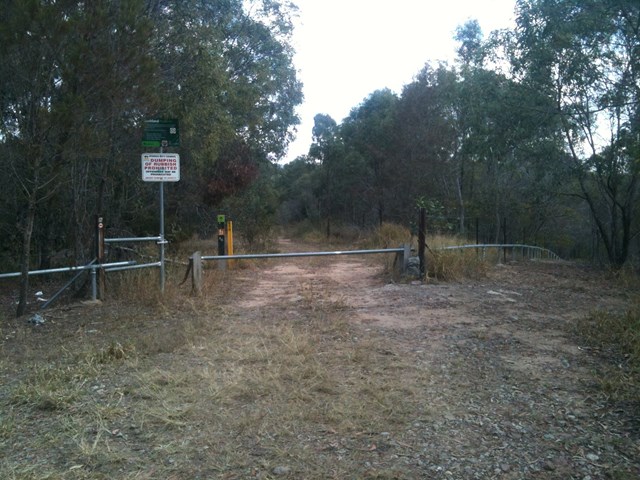
The "official" posted trail begins at Springfield Beaudesert Connection Road and ends at Huntingdale Road, however, if you continue to follow the track past the "END" sign, it will take you to the edge of Spring Mountain Forest Park.
Permits/Costs
None that are known of.
Other References
How can I find more info? Any guide books?
GPS Tracks
Where
Click here to load this map.
Comments