
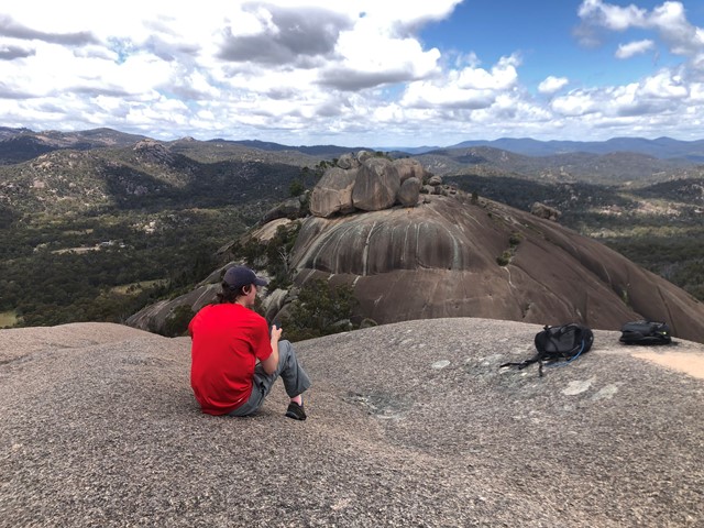
Second Pyramid
Girraween National Park


Menu
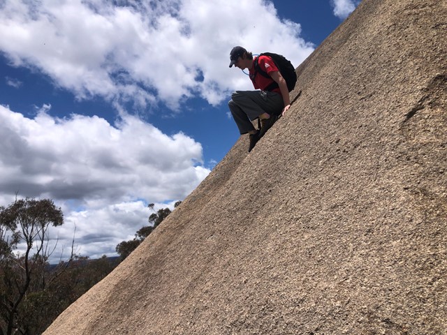

THIS IS AN OFF TRACK WALK. Long way round + 1.4km. Short way round and up +0.9km. Very good scrambling skills or medium rock climbing skills required. As always do not attempt to climb just before, during or just after rain as the rock face can be extremely slippery.

Getting there:
Girraween NP is situated approximately 260km by road south-west of Brisbane. To reach the park, turn off the New England Highway 26km south of Stanthorpe or 30km north of Tenterfield onto Pyramids Road. The winding bitumen road continues a further 9km east through the Wyberba Valley to the park's Information Centre and day use picnic area.
An alternative road from Stanthorpe to Girraween via Eukey and Storm King Dam has some gravel sections.
Maps:
Route/Trail notes:
Long way:
From the walk to the first pyramid when the steps finish and near altitude of 980m-1000m follow the bottom of the first pyramid around and to the base of the second pyramid and around to the NE corner this is where to start your approach from. Using a zigzag scrambling method and upwards towards the top of the second pyramid as you go along follow the contour of the rock this will aid you.
Short way:
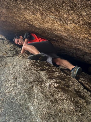
Follow the same directions until you come to the middle of the two pyramids this will be the area in which you will climb. Scramble up through till you can locate a main vein coming from the top SSW. Use this vein to aid you, scramble using the low side of the vein as a hand hold and once you reach the top of the vein go over the top of it and locate a small crack going SSW to the top it will run out, but by this time it should be just a matter of scrambling your way to the top.
Permits/Costs:
None.
Other References:
Inform ranger at information centre about your climb before proceeding and NEVER climb alone.
With so many bushwalking options in the park, why not take advantage of the excellent camping facilities at Castle Rock.
GPS Tracks
- No GPS available for this walk yet.
 4.8
4.8 2.5
2.5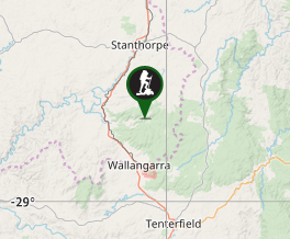
Comments