
Cooby Dam Lakeside Walk
Darling Downs South West


Menu
A scenic lakeside trail at Cooby Dam, stretching from the picnic area at Loveday Cove to the dam wall. Some sections have a formed track, while other grassy sections may be overgrown or boggy. A great spot for photographing water birds, with good picnic facilities and a large playground.
Officially listed as Grade 3/Medium (some unformed paths + steep/slippery sections), this track is suitable for walkers of most fitness levels.

Getting there
The turnoff to Cooby Dam is between Highfields and Meringandan, and is accessed via a dirt road (suitable for 2WD). Park at either of the 2 day use areas - Loveday Cove and Cooby Dam Wall. Loveday Cove has a boat ramp and a large picnic ground/playground and there are a number of picnic areas at the Cooby Dam Wall. It is a good idea to check the dam's open/closed status on the Toowoomba Regional Council website before visiting the dam as there are frequent closures due to maintenence/flood events etc.
Maps
https://www.google.com/maps/place/Cooby+Dam/@-27.3796491,151.9257321,14z/data=!3m1!4b1!4m5!3m4!1s0x6b9664497e5b3ad9:0x2a00eef1b6b894e0!8m2!3d-27.3857699!4d151.9418727
Route/Trail notes
This walk can be commenced at either end. Return via the same route.
From Loveday Cove, park near the boat ramp. There is no formed path at the beginning of the walk - just head left along the water's edge. You will pass the sailing club building then a grassy section that may be overgrown or boggy. The formed path begins just after you pass another small carpark. Landmarks to look out for are the fishing pontoon, a toilet and a wooden footbridge. After the footbridge the track becomes more rugged and begins a steep incline. Great views from the top of the hill, then continue down the other side towards the dam wall.
Permits and Fees
There used to be a fee to access Loveday Cove via a boom gate, but the gate has been open for quite a while now and payment is no longer required.
GPS Tracks
- No GPS available for this walk yet.
 4.42
4.42 90
90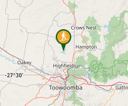
Comments