
Cedar Creek to White Cedar Picnic Ground
Brisbane Forest park D'Aguilar National Park


Menu
A Walk over the D'Aguilar Range via Maiala Picnic Ground.

Getting there
From Ferny Grove Railway Station follow Samford Rd to Samford and turn right at the round about in Samford at the Petrol Station. Drive through the shopping centre at Samford and follow the Dayborough Rd for about 10km to the Cedar Creek turnoff about 2 km past a Nursery. Simply follow this winding road to its end crossing the creek about 3 times. Park just after the bridge on the left where the locked gate stops further progress.
You will need to organise a pick up at White Cedar. Simply follow the road past Maiala picnic ground at Mt Glorious and follow the Northbrook Rd about 15 min past Maiala.
Maps
The Brisbane Forest park Map.
Route/Trail notes
To begin this walk from your car follow any of the tracks to the creek. Beware the locals are very protective of their property and barbed wire fences about shin high are near the private property signs.
Rock hop upstream for about 30 min, note there are different ways to walk up the creek. After 10 mins there is a path on the left bank facing upstream, which avoids some difficult scrambles if you stay in the creek. On this path there are obvious camp sites that have been used. It is disappointing to see graffiti on the rocks in this area. Follow this path until you reach a large cascade and cross to the right bank wherever you can. Rock hop up the bank over a couple fallen trees till you reach Cedar Creek Falls. The falls do have a sign to let you know you are there but there are some rather huge and ugly graffitti on the cascades rocks. You will shake your head at the ignorance of some idiots! Climb this cascade by its path of least resistance and rock hop up the creek. There is an area that the locals have made their own path along the creek. I found this easier to follow on the right bank. After this path you will need to go back to rock hopping. Soon after starting to rock hop Black Creek enters on your right from Mt. D'Aguilar and the creek splits into a dry water course and the actual creek. Make sure you follow the DRY water course up Cedar Creek. There is a lot of scunge and thorny vines if you stay with the flowing creek.
After another half hour of rock hopping over some beautiful rocks and dappled pools of water you will come to a rather large step some 3metres high with a creek entering to the left. This is the junction of Love Creek and Cedar Creek. Follow the Creek on the left up stream. At the first Cascade scramble up the left bank. At the top you will find a faint trail that continues steeply up the creek. There are at least 13 different cascades to climb, some on the left side some on the right make sure you follow the path of least resistance. I found at the slot waterfall that on the far left bank was the best way to negotiate this long cascade. There is a tree trunk that allows easy scrambling up the bank. Each cascade lifts you higher. After and hour of this steep rock hopping you will be at the base of Green Falls. Cross to the right bank and follow the old steps up to the large log that blocks the path. Climb over this log and climb up onto the viewing platform at the End of the Green Falls walk. Follow the Green Falls walk back to Maila Picnic Ground and locate and follow the Western Side Track and follow this to Lawnton Rd.
Follow this 4wd track for about 2 Km and when you get to the second Bee Apiary find a footrail on your left hand side that heads towards the hill. Follow this pathwest steeply uphill for about 300m where it turns south and again gains ground steeply towards the eastern Summit of Northbrook Mountain. When you arrive at the top of east Northbrook turn West or RIGHT and follow the faint trail that follows the ridgetop. If you turn left or south east you are heading down into England Creek! Follow the ridgetop up, down and around the rocky Tors. From the top of these you will get nice views of the Brisbane, Fassifern and Lockyer valleys. Make sure you follow the faint trail or stick to the ridgetop if you lose the trail and always head in a westerly direction. Eventually whichever way you followed you will reach a flat area with a steep ascent, this is the ascent to Northbrook Mountain, make sure you follow the faint trail up and when you reach a steep rock wall just follow its base to a steep rocky area and head straight up to the summit. Once at the top, where there are nice views, head west again and follow the faint trail down. After a short time you will cross a fallen log, the trail turns south west and plunges steeply down. You know you are on the path if you pass between two leaning trees. This path soon turns into an overgrown logging trail and then rises steeply and then descends again before joining England Creek Rd. When you join this road turn right up hill and once over this hill you will be at the water tank which is the junction of England Creek Rd and Lawnton Rd. At the tank follow the left 4wd track Lawnton Rd downhill.
Follow Lawnton Rd. Downhill for about 1.5km and after a slight rise another 4wd track will veer off to the right. Follow this track steeply downhill for about 4km. It is rocky and loose in some places. When you are almost at Northbrook Creek the path turns left, do not go straight ahead! Cross the creek when you reach it and follow the faint path uphill to the Northbrook Rd. Turn left at the road and walk about 500m, crossing the bridge, to the White Cedar Picnic ground. Where hopefully your ride awaits.
Permits/Costs
If you wish to camp at Nrothbrook Mountain it will cost $5. Permit book online via DERM.
Other References
Nil
GPS Tracks
- No GPS available for this walk yet.
 18
18 7
7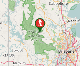
Comments