
Themeda Track
Mt. Coot-tha


Menu
A great starter walk for those looking to get into hiking. About 2.5kms in length.
Horses Permitted
Cycling Permitted
Eucalypt Forest
80m
Maximum Elevation
50m
Total Climb

Getting there
How do you get to the start of the walk?
Park beside Crag Road, signs will direct you to the start of the trail
Maps
Which maps cover the area?
Brisbane City Council Mt Cootha Maps
Route/Trail notes
A few up and down parts will a small stream crossing. You can see houses and hear the freeway for most of the walk. Good for introducing bush walking to someone new.
Permits/Costs
Free
Other References
https://www.brisbane.qld.gov.au/sites/default/files/20160729-mt_coot-tha_forest_track_map.pdf
GPS Tracks
- No GPS available for this walk yet.
 2.5
2.5 1
1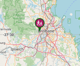
Comments