
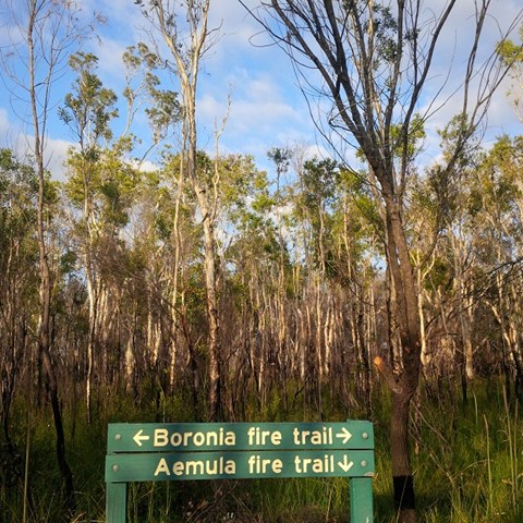
Aemula Trail
Mooloolah River National Park


Menu
GPS Tracks
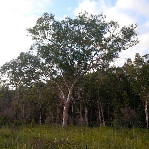
Adjoining the Mooloolah River, the Mooloolah River National Park protects valuable remnants of coastal lowland habitat, rainforest, open eucalypt woodlands, melaleuca forests, wallum banksia woodlands, scribbly gum open forests, wallum heath and sedgelands.

Getting there:
Take the Kawana Way exit off the Sunshine Motorway. To your right, you will see a rough off-road track that runs along the edge of the Park. At 1.5km there is a distinct entrance into the Park.
Map:
http://www.npsr.qld.gov.au/parks/mooloolah-river/about.html
Route/Trail notes:
This clearly defined trail cuts south and then travels west to meet with the Boronia Trails and back.
Permits/Costs:
None
Other References/Comments:
You can extend your walk by doing a full circuit. When you meet the Boronia Trail, turn north and then east along the Littoralis Trail to your start point.
 Aemula Trail & Circuit (KML)
 2.6
2.6 90
90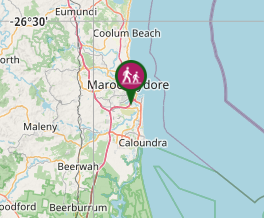
Comments