
Neutral Bay to Kirribilli
Greater Sydney


Menu
GPS Tracks
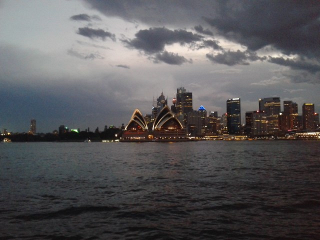
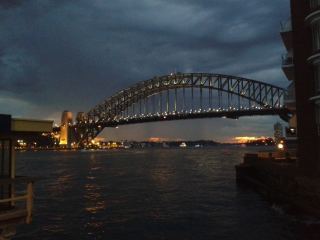

Beginning at Neutral Bay Ferry Terminal this walk will take you along the bay side through Kirribilli. You will see some of the best views of the Harbor Bridge and Opera House. The walk finishes at Milsons Point Ferry Terminal (Luna Park).

Getting there
Start at Neutral Bay Ferry Terminal.
Maps
Which maps cover the area?
Route/Trail notes
Our walk begins at Neutral Bay Wharf, where, in the old tram loop, a plaque marks the site of the Neutral Bay Shuttle Tram Service which ran from 1900-1956.
• Head back to Kurraba Rd and turn left. Near the corner of Kurraba up Ben Boyd Rd are two old plaques dedicated to controversial entrepreneur, Ben Boyd, who built a successful whaling and trading business using indentured labourers from the Pacific Islands. His mansion ‘Craignathan’ and warehouse were located on the waterfront in Hayes St.
• Proceed along Kurraba Rd to Anderson Park. Go down the steps and across the waterfront where plaques mark Charles Kingsford-Smith’s flight from Anderson Park and the settlement of Neutral Bay.
• Exit Anderson Park onto Clark Rd. Turn left and continue up and along for some way to the roundabout with McDougall St. Cross carefully and continue up Broughton St about 200 metres. In the stone embankment on the right is a plaque marking Greenway the largest blocks of flats in Australia when opened in 1954. Turn around and return to McDougall St. Turn right and proceed down to Milson Park where a plaque in the centre commemorates the creation of the park reclaimed from the cove. Continue up McDougall St and cross Willoughby St to Elamang Ave, follow this along until Peel St and turn right. Proceed up to Carabella St. A short way up on the right is No. 67 the Quarterdeck Apartments, the site of ‘Miandetta’, former home of Sir Edmund Barton, Australia’s first Prime Minister. (Note: No.65 ‘Miandetta’ is not the original house)
- Follow Carabella St back down to Kirribilli Ave, past Kirribilli House and Admiralty House to Beulah Street Wharf. A plaque marks the site of the Pastoral Finance Association Wool Store
destroyed by fire in 1921.
- Proceed back to Kirribilli Ave and along to Jeffrey St. Turn left and go down to Captain Henry Waterhouse Reserve to the left of Copes Lookout where plaques mark the role of Waterhouse and the early home Greencliffe . The Milsons Point vehicle ferry plaque is located on the right hand side of the Jeffrey St wharf. On Olympic Drive running under the pylon a plaque commemorates Thomas Raine and the convict ship Surry. Further along is a plaque marking the role of James Milson Snr in the settling of North Sydney. Two plaques near the Western Pylon of the Bridge mark the site of North Sydney’s first piped water supply and Milsons Point Ferry Arcade
- There is a ferry wharf next to the entrance to Luna Park. The entrance to Milsons Point railway station is a short walk up Alfred St under the Sydney Harbour Bridge. Buses that will take you back up to North Sydney depart from the bus stop near the Bridge
pylon.
Other References
http://www.northsydney.nsw.gov.au/files/6dcdaa89-d650-46ec-b982-a15d00ee598d/Plaques_Walk_3_Neutral_Bay_to_Kirribilli.pdf
http://www.northsydney.nsw.gov.au/Recreation_Facilities/Walking_Cycling/Walking
 Neutral Bay to Kirribilli (KML)
 3.5
3.5 1
1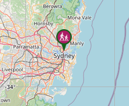
Comments