
Cathedral Rock
Cathedral Rock National Park


Menu
GPS Tracks


The Barokee campground is the starting point for this walk. It is accessed via a rather rough unsealed road off the B78.
Cathedral Rock track is an exciting and challenging walk, near to Barokee campground and Round Mountain, offering scenic views across the New England Tablelands from the summit.
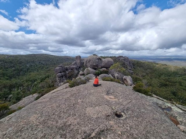
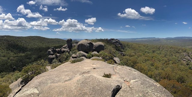
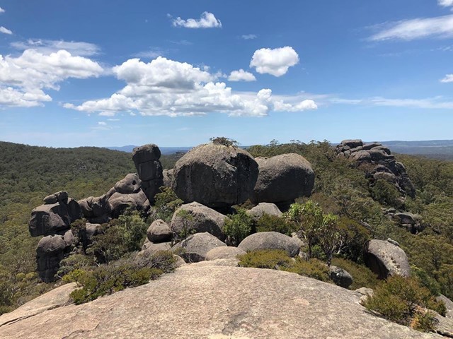
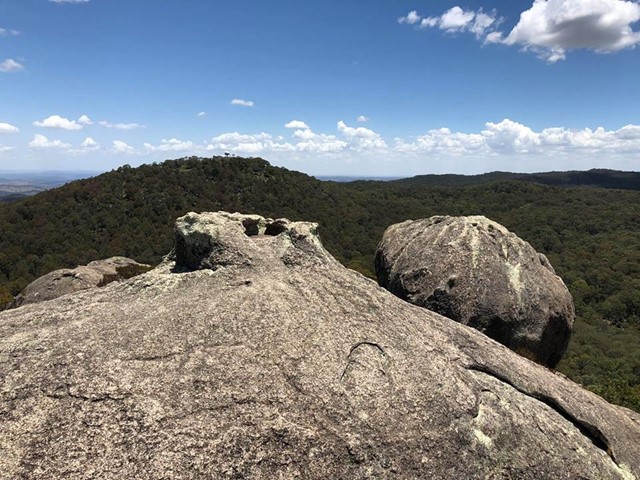
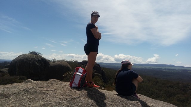
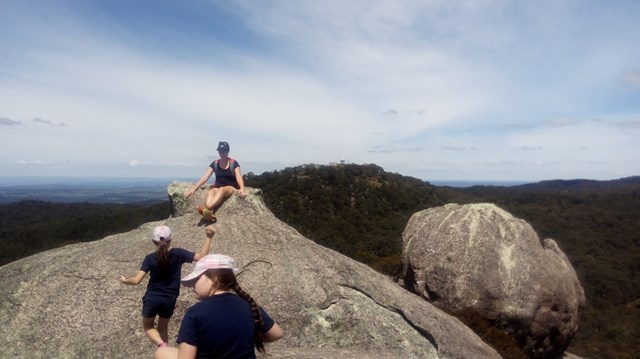
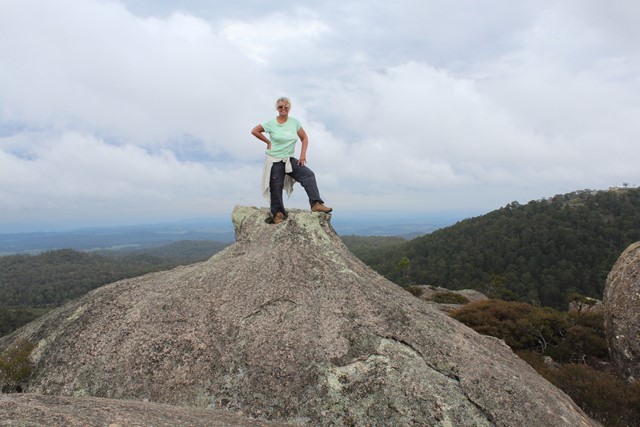
Hike up Cathedral Rock to sit on a natural throne perched on 100m of stacked boulders and survey your kingdom. The nearby Round Mountain is the highest point of the New England Tablelands, although only by a royal whisker at 1579m.

Getting there:
From Armidale, drive east on Barney Street, which soon becomes Grafton Road and later Waterfall Way (State Route 78) for 70km, passing through Argyle and Wollomombi.
To access Barokee campground, take the Round Mountain Road turnoff on the left and after 8km of narrow gravel road, turn right into the campground. A day use car park and picnic area is just on you left.
Maps:
Route/Trail notes:
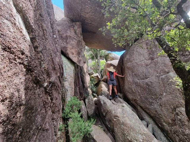
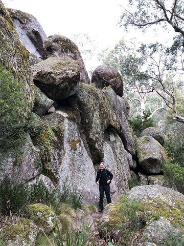
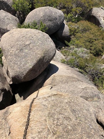
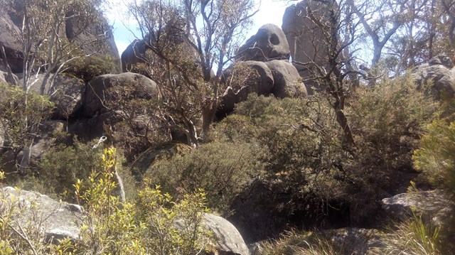
The track is accessed from the Barokee day use area. Follow the circuit clockwise and hike through sub-alpine woodland, swampy heath, wet and dry sclerophyll forest, ascending through granite outcrops to the summit turnoff. Rock-hopping is the scientific term for what you’ll be doing for much of the next 600m, as you clamber over boulders and straddle crevices. There is a chain for a particularly difficult scramble near the top. The gaps and chasms between the boulders are deep so be wary.
On the way back, keep following the circuit around to the right through a protected valley of manna gums to your starting point.
Permits/Costs:
None.
Other References/Comments:
Whilst at the Barokee day use area, take advantage of the Round Mountain walk (5.5km return).
 139 Cathedral Rock (GPX)
 5.6
5.6 3
3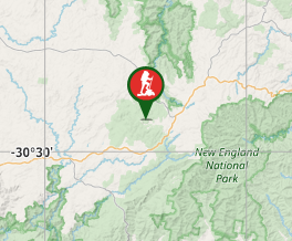
Comments