
Toolona Creek and Mount Wanungra Lookout
Lamington National Park


Menu
GPS Tracks
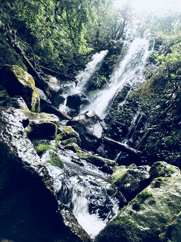


A full day walk that follows Toolona Creek in which over 8 waterfalls will be seen, also reaching Mt Wanungara lookout to provide views to Byron Bay.

Getting there
Driving from Brisbane take the Narang exit and follow signs to Canungra. Turn left in the centre of Canungra, following the signs to Lamington Plateau, Green Mountain Car Park (aka O'Reillys). From Canungra the drive takes approximately 50 minutes along narrow winding roads. Take care, particuarly with the numerous blind corners.
Maps
There is a gift shop up from the main car park where you can buy various maps that cover the local walks.
Hema Maps has a 1:25000 that covers Lamington National Park in a single map.
Sunmap sheets Tyalgum and Beechmont cover the walk in 1:25000.
There is also a National Park Information Centre with brochures which outline the track system. The applicable points where the track splits are signposted as well.
Route/Trail notes
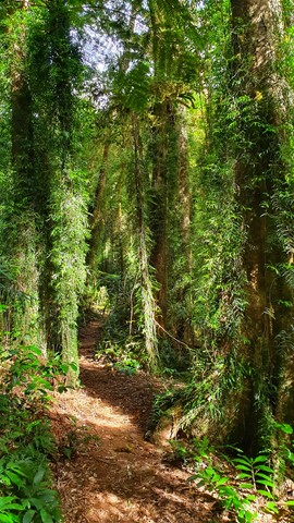
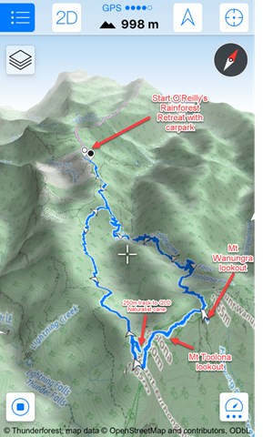
The first part of the walk to Picnic Rock is easy and the surface is a compacted rock and concrete track. Start on the border track and ignore the first turnoff (250m - Blue Pool and West Canungra Creek Circuit). Take the second exit (1.7km) leading to the Box Forest Circuit, Picnic Rock and the Toolona Creek Circuit. The Box Forest Circuit branches away from this track so take the right branch leading to Picnic Rock.
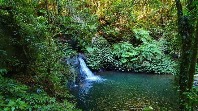
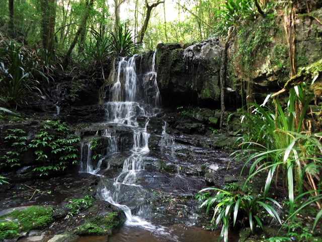
The track continues on the opposite side of the creek and continues to descend for 200m. The next branch is where the Box Forest Circuit and West Canungra Creek Circuit return. It's a crime if you don't turn left and walk 140m to see Elabana Falls. After that detour return and take the right hand turn to start on the Toolona Creek Circuit proper.
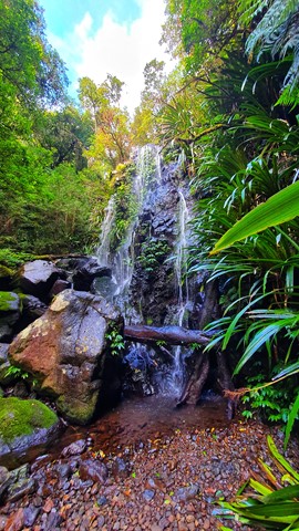
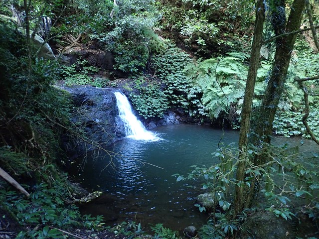
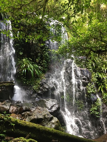
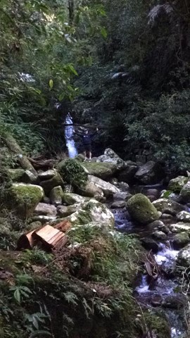
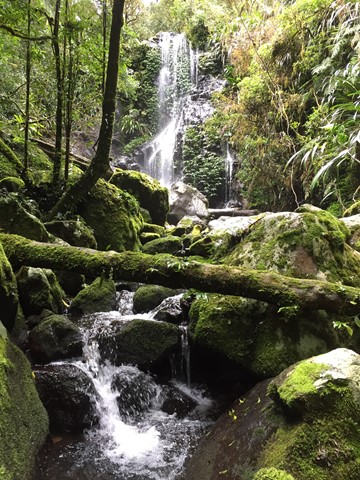
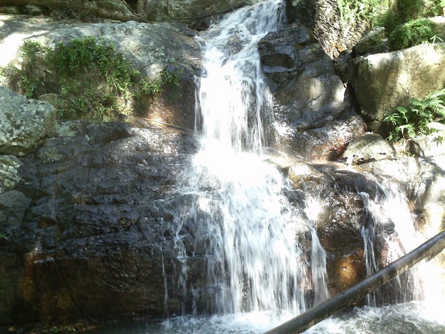
The walk along Toolona Creek crosses the creek over 5 times and takes you to or past around 7 small waterfalls (sometimes a short track will leave the main track to take you to a waterfall). It is really a spectacular walk.
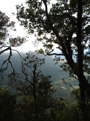
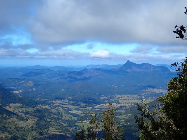
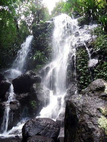
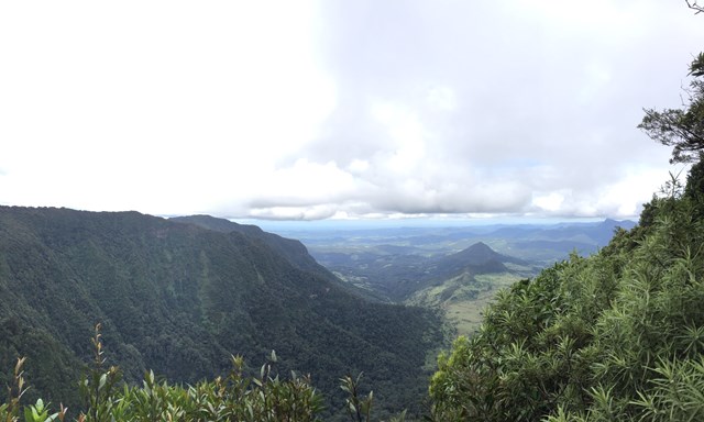
Once you reach Toolona Falls which take approximately 2 1/2; hours, you soon join up with "The Border Track". Turn left and head to Mt Wanungara it is a well signed a 100m detour to the Lookout. The Lookout is approx 50 min walk from Toolona Falls and is a good spot to take a break for lunch. Here you can see views of the Tweed Valley, Murwillimbah, Mt Warning and even Byron Bay and North Stradbroke Island on a clear day. Mt Wanungara is also home to a majestic Antarctic Beech forest.
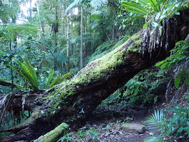
After that head back to where you first joined the Border Track and continue straight ahead towards O'Reillys. As the track heads off the ridge and down towards o'reilys the tree trunks are covered in moss and creeper plants colouring the whole place green.
Be prepared for a muddy track, particularly in the wetter months. Also be aware that recent rain may raise the creek level and make the creek crossings more interesting.
Permits/Costs
No Cost. However you can pay for guided walks.
Other References
Maps if available at the following link: https://www.npsr.qld.gov.au/parks/lamington/pdf/lamington-green-mts-map.pdf
http://www.oreillys.com.au/lamington-national-park/bushwalking/full-day-walks/
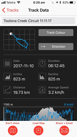
 Toolona Creek Circuit and Mt Wanungra (GPX)
 20
20 7
7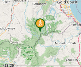
Comments